


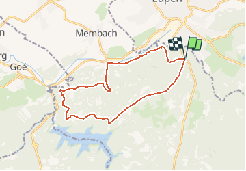
Luik - Hertogenwald Occidental

misph
Gebruiker

Lengte
13,3 km

Max. hoogte
387 m

Positief hoogteverschil
273 m
Km-Effort
16,9 km

Min. hoogte
252 m

Negatief hoogteverschil
274 m
Boucle
Ja
Datum van aanmaak :
2017-05-05 00:00:00.0
Laatste wijziging :
2017-05-05 00:00:00.0
3h38
Moeilijkheid : Medium

Gratisgps-wandelapplicatie
 SityTrail
IGN / Geografische instituten
SityTrail Plus
De wereld gaat voor u open
Over ons
Tocht Andere activiteiten van 13,3 km beschikbaar op Wallonië, Luik, Baelen. Deze tocht wordt voorgesteld door misph.
Beschrijving
Auteur: RVD 2016.
NNO meer van Gileppe.


Plaatsbepaling
Land:
Belgium
Regio :
Wallonië
Departement/Provincie :
Luik
Gemeente :
Baelen
Locatie:
Membach
Vertrek:(Dec)
Vertrek:(UTM)
290608 ; 5610735 (32U) N.
Opmerkingen