


Mittlach 3 sommets-3 lacs

LaurentGILG
Gebruiker

Lengte
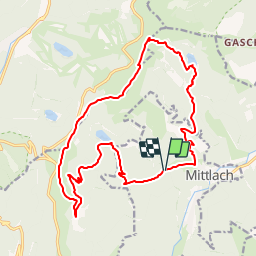
18,9 km

Max. hoogte
1349 m

Positief hoogteverschil
1172 m
Km-Effort
34 km

Min. hoogte
554 m

Negatief hoogteverschil
1162 m
Boucle
Ja
Datum van aanmaak :
2019-01-20 20:50:27.505
Laatste wijziging :
2019-01-20 20:50:27.536
7h01
Moeilijkheid : Zeer moeilijk

Gratisgps-wandelapplicatie
 SityTrail
IGN / Geografische instituten
SityTrail Plus
De wereld gaat voor u open
Over ons
Tocht Stappen van 18,9 km beschikbaar op Grand Est, Haut-Rhin, Mittlach. Deze tocht wordt voorgesteld door LaurentGILG.
Beschrijving
Mittlach, Lac du Fischboedle, Lac du Schiessrothried, Le Kastelberg, Le Rainkopf; Rotenbacchkopf, Lac d'Altenweiher, Mittlach
POI's


Plaatsbepaling
Land:
France
Regio :
Grand Est
Departement/Provincie :
Haut-Rhin
Gemeente :
Mittlach
Locatie:
Unknown
Vertrek:(Dec)
Vertrek:(UTM)
352035 ; 5318731 (32U) N.
Opmerkingen