


Candesoubre

philou6351
Gebruiker
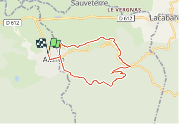

Lengte
7,7 km

Max. hoogte
522 m

Positief hoogteverschil
234 m
Km-Effort
10,8 km

Min. hoogte
314 m

Negatief hoogteverschil
234 m
Boucle
Ja
Datum van aanmaak :
2016-10-20 00:00:00.0
Laatste wijziging :
2016-10-20 00:00:00.0
2h23
Moeilijkheid : Onbekend

Gratisgps-wandelapplicatie
 SityTrail
IGN / Geografische instituten
SityTrail Plus
De wereld gaat voor u open
Over ons
Tocht Stappen van 7,7 km beschikbaar op Occitanië, Tarn, Albine. Deze tocht wordt voorgesteld door philou6351.
POI's


Plaatsbepaling
Land:
France
Regio :
Occitanië
Departement/Provincie :
Tarn
Gemeente :
Albine
Locatie:
Unknown
Vertrek:(Dec)
Vertrek:(UTM)
462719 ; 4812124 (31T) N.
Opmerkingen