


2016 11 cross Firstplan/Exa

staubalex
Gebruiker
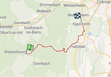

Lengte
17,4 km

Max. hoogte
768 m

Positief hoogteverschil
171 m
Km-Effort
21 km

Min. hoogte
193 m

Negatief hoogteverschil
696 m
Boucle
Neen
Datum van aanmaak :
2016-11-09 00:00:00.0
Laatste wijziging :
2016-11-09 00:00:00.0
1h21
Moeilijkheid : Medium

Gratisgps-wandelapplicatie
 SityTrail
IGN / Geografische instituten
SityTrail Plus
De wereld gaat voor u open
Over ons
Tocht Andere activiteiten van 17,4 km beschikbaar op Grand Est, Haut-Rhin, Rouffach. Deze tocht wordt voorgesteld door staubalex.
Plaatsbepaling
Land:
France
Regio :
Grand Est
Departement/Provincie :
Haut-Rhin
Gemeente :
Rouffach
Locatie:
Unknown
Vertrek:(Dec)
Vertrek:(UTM)
364598 ; 5317803 (32T) N.
Opmerkingen