20161111

Mullender
Gebruiker
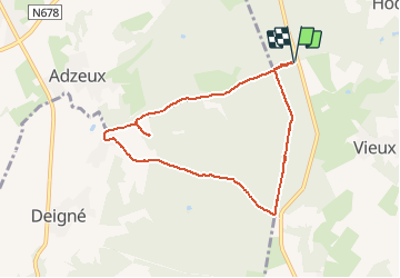

Lengte
7 km

Max. hoogte
356 m

Positief hoogteverschil
157 m
Km-Effort
9,1 km

Min. hoogte
235 m

Negatief hoogteverschil
157 m
Boucle
Ja
Datum van aanmaak :
2016-12-05 00:00:00.0
Laatste wijziging :
2016-12-05 00:00:00.0
1h33
Moeilijkheid : Onbekend

Gratisgps-wandelapplicatie
 SityTrail
IGN / Geografische instituten
SityTrail Plus
De wereld gaat voor u open
Over ons
Tocht Stappen van 7 km beschikbaar op Wallonië, Luik, Theux. Deze tocht wordt voorgesteld door Mullender.
Plaatsbepaling
Land:
Belgium
Regio :
Wallonië
Departement/Provincie :
Luik
Gemeente :
Theux
Locatie:
Theux
Vertrek:(Dec)
Vertrek:(UTM)
696082 ; 5600340 (31U) N.
Opmerkingen