


Biesme sous thuin

schef
Gebruiker
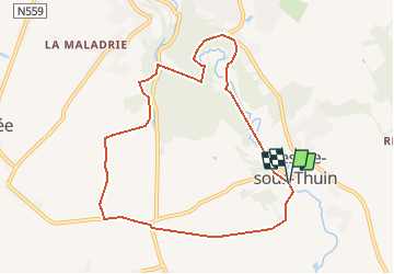

Lengte
8,1 km

Max. hoogte
184 m

Positief hoogteverschil
143 m
Km-Effort
10 km

Min. hoogte
133 m

Negatief hoogteverschil
142 m
Boucle
Ja
Datum van aanmaak :
2017-03-14 00:00:00.0
Laatste wijziging :
2017-03-14 00:00:00.0
1h40
Moeilijkheid : Medium

Gratisgps-wandelapplicatie
 SityTrail
IGN / Geografische instituten
SityTrail Plus
De wereld gaat voor u open
Over ons
Tocht Noords wandelen van 8,1 km beschikbaar op Wallonië, Henegouwen, Thuin. Deze tocht wordt voorgesteld door schef.
Plaatsbepaling
Land:
Belgium
Regio :
Wallonië
Departement/Provincie :
Henegouwen
Gemeente :
Thuin
Locatie:
Biesme-sous-Thuin
Vertrek:(Dec)
Vertrek:(UTM)
593042 ; 5574922 (31U) N.
Opmerkingen