Tocht Andere activiteiten Spechbach - Gilles - Photo
 gschwind
gschwind

Gebruiker

© OpenStreetMap contributors
Lengte
Lengte
4,1 km
Max. hoogte
Max. hoogte
282 m
Positief hoogteverschil
22 m
Km-Effort
Km-Effort  
4,4 km
Min. hoogte
Min. hoogte
263 m
Negatief hoogteverschil
26 m
Boucle
Boucle
Neen
Datum van aanmaak :
2017-04-19 00:00:00.0
Laatste wijziging :
2017-04-19 00:00:00.0

(0 Bericht)

Andere activiteiten
Andere activiteiten
1h10
Moeilijkheid : Onbekend

Scan deze QR-code om de tocht te openen in de SityTrail-applicatie

Gratisgps-wandelapplicatie

Logo SityTrail SityTrail

IGN / Geografische instituten

SityTrail uit de App Store downloaden SityTrail uit Google Play downloaden

Logo SityTrail SityTrail World

De wereld gaat voor u open

SityTrail uit de App Store downloaden SityTrail uit Google Play downloaden SityTrail op Huawei AppGallery downloaden

Over ons

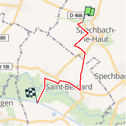
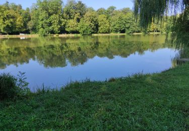
Tocht Andere activiteiten van 4,1 km beschikbaar op Grand Est, Haut-Rhin, Spechbach. Deze tocht wordt voorgesteld door gschwind.

Beschrijving

Spechbach le haut - canal
4 km

Hoogteprofiel

Plaatsbepaling

Land:
France
Regio :
Grand Est
Departement/Provincie :
Haut-Rhin
Gemeente :
Spechbach
Locatie:
Unknown
Vertrek:(Dec)
Vertrek:(UTM)
365843 ; 5282735 (32T) N.

Wandeltochten in de omgeving

Tocht Stappen Heimsbrunn - Heimsbrunn  - Photo
Stappen
ROPPJP

Stappen

Heel gemakkelijk
(1)
Heimsbrunn, Grand Est, Haut-Rhin, France
8,7 km | 9,5 km-effort
2h 14min
Ja
Tocht Stappen Illfurth - Illfurth Luemschwillrr Obermorschwiller - Photo
Stappen
selevrich

Stappen

Gemakkelijk
Illfurth, Grand Est, Haut-Rhin, France
28 km | 34 km-effort
3h 28min
Neen
Tocht Stappen Heimsbrunn - 19.06.14.Heimsbrunn  - Photo
Stappen
ROPPJP

Stappen

Heel gemakkelijk
Heimsbrunn, Grand Est, Haut-Rhin, France
6,4 km | 7,1 km-effort
1h 17min
Ja
Tocht Stappen Walheim - Walheim-Illfuhrt (1-3-2018) - Photo
Stappen
Richard68500

Stappen

Gemakkelijk
Walheim, Grand Est, Haut-Rhin, France
13,6 km | 18,2 km-effort
3h 32min
Ja
Tocht Lopen Walheim - noel - Photo
Lopen
flip6868

Lopen

Gemakkelijk
Walheim, Grand Est, Haut-Rhin, France
5,3 km | 6,8 km-effort
55min
Ja
Tocht Lopen Walheim - noel - Photo
Lopen
flip6868

Lopen

Gemakkelijk
Walheim, Grand Est, Haut-Rhin, France
5,3 km | 6,8 km-effort
55min
Ja
Tocht Mountainbike Walheim - 2010-10-31 - 10h56m09 - Photo
Mountainbike
sergeh68

Mountainbike

Heel gemakkelijk
Walheim, Grand Est, Haut-Rhin, France
34 km | 42 km-effort
Onbekend
Ja
Tocht Stappen Heimsbrunn - Heimsbrunn Rein Morschwiller  - Photo
Stappen
ROPPJP

Stappen

Medium
Heimsbrunn, Grand Est, Haut-Rhin, France
9,3 km | 10,6 km-effort
1h 58min
Ja
Tocht Stappen Frœningen - Étang de Galfingue  - Photo
Stappen
ROPPJP

Stappen

Medium
Frœningen, Grand Est, Haut-Rhin, France
4,9 km | 6 km-effort
1h 18min
Ja


Sluiten
Mijn abonnementen