


TDP N°11 BORCE GABAS

jeff2
Gebruiker

Lengte
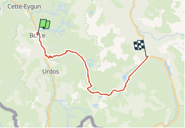
26 km

Max. hoogte
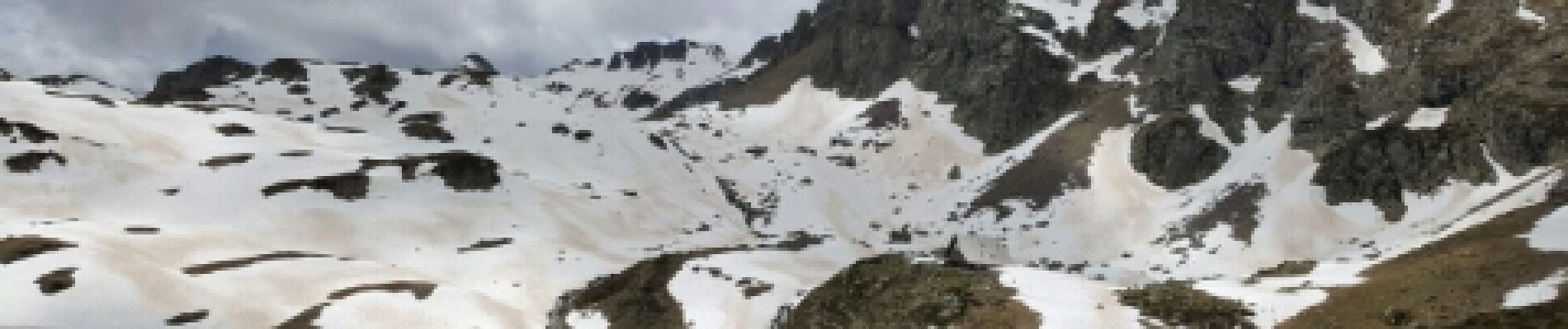
2189 m

Positief hoogteverschil
2239 m
Km-Effort
55 km

Min. hoogte
595 m

Negatief hoogteverschil
1852 m
Boucle
Neen
Datum van aanmaak :
2017-05-15 00:00:00.0
Laatste wijziging :
2017-05-15 00:00:00.0
8h31
Moeilijkheid : Onbekend

Gratisgps-wandelapplicatie
 SityTrail
IGN / Geografische instituten
SityTrail Plus
De wereld gaat voor u open
Over ons
Tocht Andere activiteiten van 26 km beschikbaar op Nieuw-Aquitanië, Pyrénées-Atlantiques, Borce. Deze tocht wordt voorgesteld door jeff2.
Beschrijving
Gros dénivelé
Foto's


21 fotos in totaal. Klik op een foto om ze allemaal in de galerij weer te geven.


Plaatsbepaling
Land:
France
Regio :
Nieuw-Aquitanië
Departement/Provincie :
Pyrénées-Atlantiques
Gemeente :
Borce
Locatie:
Unknown
Vertrek:(Dec)
Vertrek:(UTM)
698160 ; 4753459 (30T) N.
Opmerkingen