


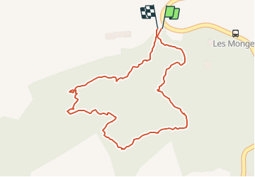

38 km | 45 km-effort


Gebruiker


Gratisgps-wandelapplicatie
 SityTrail
IGN / Geografische instituten
SityTrail World
De wereld gaat voor u open
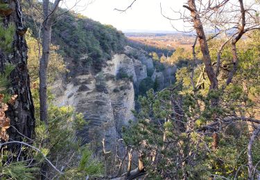
Tocht Andere activiteiten van 1,2 km beschikbaar op Provence-Alpes-Côte d'Azur, Vaucluse, Valréas. Deze tocht wordt voorgesteld door ddl26.
Pour projet
Fiets
Stappen
Stappen
Stappen
Stappen
Stappen
Stappen
Stappen
Stappen