


17.06.2017 - HILLION Virtuel 25,3 k

babeth35
Gebruiker

Lengte
25 km

Max. hoogte
73 m

Positief hoogteverschil
362 m
Km-Effort
30 km

Min. hoogte
-1 m

Negatief hoogteverschil
361 m
Boucle
Ja
Datum van aanmaak :
2017-06-17 00:00:00.0
Laatste wijziging :
2020-07-20 15:15:45.75
6h30
Moeilijkheid : Moeilijk

Gratisgps-wandelapplicatie
 SityTrail
IGN / Geografische instituten
SityTrail Plus
De wereld gaat voor u open
Over ons
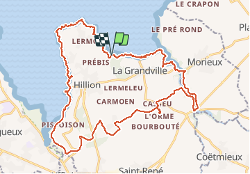
Tocht Stappen van 25 km beschikbaar op Bretagne, Côtes-d'Armor, Hillion. Deze tocht wordt voorgesteld door babeth35.
Plaatsbepaling
Land:
France
Regio :
Bretagne
Departement/Provincie :
Côtes-d'Armor
Gemeente :
Hillion
Locatie:
Unknown
Vertrek:(Dec)
Vertrek:(UTM)
525494 ; 5374636 (30U) N.
Opmerkingen