


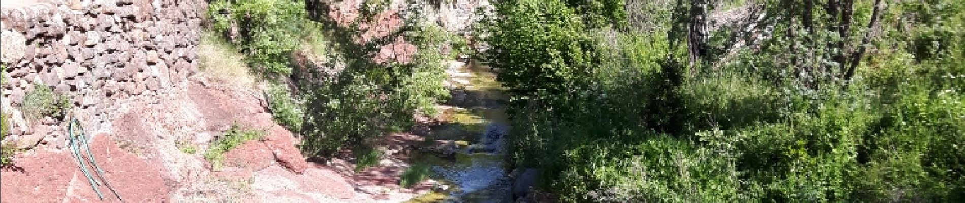
chapelle Notre-Dame de Roubignac

amiral13
Gebruiker GUIDE
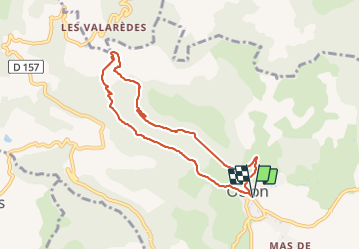

Lengte
8,2 km

Max. hoogte
389 m

Positief hoogteverschil
253 m
Km-Effort
11,5 km

Min. hoogte
187 m

Negatief hoogteverschil
254 m
Boucle
Ja
Datum van aanmaak :
2017-07-09 00:00:00.0
Laatste wijziging :
2017-07-09 00:00:00.0
4h44
Moeilijkheid : Onbekend

Gratisgps-wandelapplicatie
 SityTrail
IGN / Geografische instituten
SityTrail Plus
De wereld gaat voor u open
Over ons
Tocht Andere activiteiten van 8,2 km beschikbaar op Occitanië, Hérault, Octon. Deze tocht wordt voorgesteld door amiral13.
Foto's


Plaatsbepaling
Land:
France
Regio :
Occitanië
Departement/Provincie :
Hérault
Gemeente :
Octon
Locatie:
Unknown
Vertrek:(Dec)
Vertrek:(UTM)
524498 ; 4833469 (31T) N.
Opmerkingen