


Gros pounch

aljac
Gebruiker
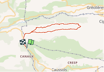

Lengte
15,8 km

Max. hoogte
1265 m

Positief hoogteverschil
397 m
Km-Effort
21 km

Min. hoogte
1041 m

Negatief hoogteverschil
397 m
Boucle
Ja
Datum van aanmaak :
2018-04-17 11:11:06.036
Laatste wijziging :
2018-04-17 11:11:06.036
5h15
Moeilijkheid : Onbekend

Gratisgps-wandelapplicatie
 SityTrail
IGN / Geografische instituten
SityTrail Plus
De wereld gaat voor u open
Over ons
Tocht Andere activiteiten van 15,8 km beschikbaar op Provence-Alpes-Côte d'Azur, Alpes-Maritimes, Caussols. Deze tocht wordt voorgesteld door aljac.


Plaatsbepaling
Land:
France
Regio :
Provence-Alpes-Côte d'Azur
Departement/Provincie :
Alpes-Maritimes
Gemeente :
Caussols
Locatie:
Unknown
Vertrek:(Dec)
Vertrek:(UTM)
327855 ; 4847389 (32T) N.
Opmerkingen