Tocht Stappen Marolles-en-Hurepoix - MAROLLES --> LARDY 12 KM - Photo
 gemau77
gemau77

Gebruiker

© OpenStreetMap contributors
Lengte
Lengte
12 km
Max. hoogte
Max. hoogte
160 m
Positief hoogteverschil
215 m
Km-Effort
Km-Effort  
14,9 km
Min. hoogte
Min. hoogte
61 m
Negatief hoogteverschil
217 m
Boucle
Boucle
Neen
Datum van aanmaak :
2019-03-18 15:03:06.787
Laatste wijziging :
2021-11-08 13:58:13.102

(0 Bericht)

Stappen
Stappen
3h11
Moeilijkheid : Onbekend

Scan deze QR-code om de tocht te openen in de SityTrail-applicatie

Gratisgps-wandelapplicatie

Logo SityTrail SityTrail

IGN / Geografische instituten

SityTrail uit de App Store downloaden SityTrail uit Google Play downloaden

Logo SityTrail SityTrail World

De wereld gaat voor u open

SityTrail uit de App Store downloaden SityTrail uit Google Play downloaden SityTrail op Huawei AppGallery downloaden

Over ons

Tocht Stappen van 12 km beschikbaar op Île-de-France, Essonne, Marolles-en-Hurepoix. Deze tocht wordt voorgesteld door gemau77.

Beschrijving

Ne pas traverser les voies.

Hoogteprofiel

POI's

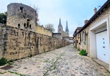
POI Marolles-en-Hurepoix - église - Photo
gemau77
MAROLLES-EN-HUREPOIX 
POI Lardy - Lavoir - Photo
gemau77
LARDY 
POI Lardy - église - Photo
gemau77
LARDY 
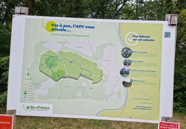
POI Lardy - Raccourci - Photo
gemau77
LARDY 
POI Lardy - Bouray - Photo
gemau77
LARDY 

Plaatsbepaling

Land:
France
Regio :
Île-de-France
Departement/Provincie :
Essonne
Gemeente :
Marolles-en-Hurepoix
Locatie:
Unknown
Vertrek:(Dec)
Vertrek:(UTM)
447717 ; 5379349 (31U) N.

Wandeltochten in de omgeving

Tocht Stappen Lardy - Lardy - Chamarande -F - Photo
Stappen
nicolas93

Stappen

Medium
(2)
Lardy, Île-de-France, Essonne, France
18,3 km | 22 km-effort
4h 44min
Ja
Tocht Stappen Marolles-en-Hurepoix - Marolles Lardy Bouray St Vrain - Photo
Stappen
philippebenne

Stappen

Medium
(1)
Marolles-en-Hurepoix, Île-de-France, Essonne, France
19,3 km | 23 km-effort
5h 10min
Ja
Tocht Stappen Lardy - Autour de Lardy par la Pierre levée de Janville sur Juine - Photo
Stappen
tracegps

Stappen

Moeilijk
(1)
Lardy, Île-de-France, Essonne, France
24 km | 29 km-effort
4h 49min
Ja
Tocht Mountainbike Lardy - Autour de Lardy en VTT - Photo
Mountainbike
tracegps

Mountainbike

Medium
(1)
Lardy, Île-de-France, Essonne, France
31 km | 38 km-effort
2h 4min
Ja
Tocht Te voet Itteville - Chemin des Marais - Photo
Te voet
PRO

Te voet

Gemakkelijk
Itteville, Île-de-France, Essonne, France
14,3 km | 16 km-effort
3h 38min
Neen
Tocht Te voet Lardy - Boucle Lardy par Pascale - Photo
Te voet
chessyca

Te voet

Gemakkelijk
Lardy, Île-de-France, Essonne, France
20 km | 25 km-effort
5h 36min
Ja
Tocht Stappen Cheptainville - Forêt Régionale de Cheptainville  - Photo
Stappen
guydu41

Stappen

Gemakkelijk
Cheptainville, Île-de-France, Essonne, France
7,2 km | 8,8 km-effort
1h 51min
Ja
Tocht Te voet La Norville - FR-7 - Photo
Te voet
PRO

Te voet

Gemakkelijk
La Norville, Île-de-France, Essonne, France
4,1 km | 4,7 km-effort
1h 4min
Neen
Tocht Stappen Itteville - 2020-05-23 itteville Baulne 17 km - Photo
Stappen
Lucquiaud

Stappen

Medium
Itteville, Île-de-France, Essonne, France
17,7 km | 20 km-effort
5h 38min
Ja


Sluiten
Mijn abonnementen