


2018 02 07 DH Cross Turen

staubalex
Gebruiker
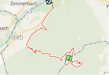

Lengte
8,6 km

Max. hoogte
631 m

Positief hoogteverschil
86 m
Km-Effort
10,9 km

Min. hoogte
261 m

Negatief hoogteverschil
452 m
Boucle
Neen
Datum van aanmaak :
2018-04-17 18:03:26.147
Laatste wijziging :
2018-04-17 18:03:26.147
2h16
Moeilijkheid : Gemakkelijk

Gratisgps-wandelapplicatie
 SityTrail
IGN / Geografische instituten
SityTrail Plus
De wereld gaat voor u open
Over ons
Tocht Andere activiteiten van 8,6 km beschikbaar op Grand Est, Haut-Rhin, Wintzenheim. Deze tocht wordt voorgesteld door staubalex.
Plaatsbepaling
Land:
France
Regio :
Grand Est
Departement/Provincie :
Haut-Rhin
Gemeente :
Wintzenheim
Locatie:
Unknown
Vertrek:(Dec)
Vertrek:(UTM)
370423 ; 5323315 (32U) N.
Opmerkingen