


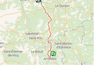
030 Arfeuille Montcombroux les mines

MERMOZ33
Gebruiker

Lengte
31 km

Max. hoogte
489 m

Positief hoogteverschil
763 m
Km-Effort
42 km

Min. hoogte
309 m

Negatief hoogteverschil
812 m
Boucle
Neen
Datum van aanmaak :
2018-04-17 18:06:47.729
Laatste wijziging :
2018-04-17 18:06:47.729
8h42
Moeilijkheid : Medium

Gratisgps-wandelapplicatie
 SityTrail
IGN / Geografische instituten
SityTrail Plus
De wereld gaat voor u open
Over ons
Tocht Stappen van 31 km beschikbaar op Auvergne-Rhône-Alpes, Allier, Arfeuilles. Deze tocht wordt voorgesteld door MERMOZ33.
Plaatsbepaling
Land:
France
Regio :
Auvergne-Rhône-Alpes
Departement/Provincie :
Allier
Gemeente :
Arfeuilles
Locatie:
Unknown
Vertrek:(Dec)
Vertrek:(UTM)
556118 ; 5111502 (31T) N.
Opmerkingen