Tocht Stappen Les Houches - TMB - Photo
 Pascalvedrin
Pascalvedrin

Gebruiker

© OpenStreetMap contributors
Lengte
Lengte
168 km
Max. hoogte
Max. hoogte
2672 m
Positief hoogteverschil
11660 m
Km-Effort
Km-Effort  
324 km
Min. hoogte
Min. hoogte
975 m
Negatief hoogteverschil
11659 m
Boucle
Boucle
Ja
Datum van aanmaak :
2018-04-17 18:10:20.282
Laatste wijziging :
2018-04-17 18:10:20.282

(0 Bericht)

Stappen
Stappen
60h45
Moeilijkheid : Medium

Scan deze QR-code om de tocht te openen in de SityTrail-applicatie

Gratisgps-wandelapplicatie

Logo SityTrail SityTrail

IGN / Geografische instituten

SityTrail uit de App Store downloaden SityTrail uit Google Play downloaden

Logo SityTrail SityTrail Plus

De wereld gaat voor u open

SityTrail uit de App Store downloaden SityTrail uit Google Play downloaden SityTrail op Huawei AppGallery downloaden

Over ons

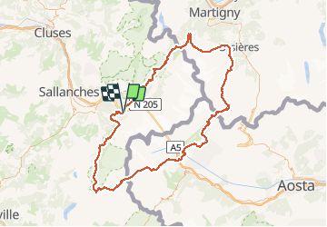
Tocht Stappen van 168 km beschikbaar op Auvergne-Rhône-Alpes, Haute-Savoie, Les Houches. Deze tocht wordt voorgesteld door Pascalvedrin.

Beschrijving

Tour du Mont-Blanc du 17 au 26 juin 2017.
1. Les Houches-Les Contamines-Montjoie, par le Col de Tricot (variante).
2. Les Contamines-Les Mottets par la variante du Col des Fours.
3. Les Mottets-Rifugio Maison-Vieille
4. Maison-Vieille-Rifugio Bertone
5. Bertone-Rifugio Elena, par variante tête Bernarda
6. Elena-Champex-lac
7. Champex-Col de la Forclas par la Variante Fenêtre de l'Arpette
8. Forclaz - Tré-le-Champ par l'Aiguillette
9. Tré-le-Champ - La Flégère par le Lac Blanc
10. La Flégère - Les Houches par le sommet du Brévent

Hoogteprofiel

POI's

POI Les Contamines-Montjoie - Etape 1 - Photo
Pascalvedrin
LES CONTAMINES-MONTJOIE 
POI Bourg-Saint-Maurice - Etape 2 - Photo
Pascalvedrin
BOURG-SAINT-MAURICE 
POI Courmayeur - Loup - Photo
Pascalvedrin
COURMAYEUR 
POI Courmayeur - Loup - Photo
Pascalvedrin
COURMAYEUR 
POI Courmayeur - Etape 3 - Photo
Pascalvedrin
COURMAYEUR 
POI Courmayeur - Etape 4 - Photo
Pascalvedrin
COURMAYEUR 
POI Courmayeur - Etape 5 - Photo
Pascalvedrin
COURMAYEUR 
POI Orsières - Etape 6 - Photo
Pascalvedrin
ORSIÈRES 
POI Trient - Etape 7 - Photo
Pascalvedrin
TRIENT 
POI Chamonix-Mont-Blanc - Etape 8 - Photo
Pascalvedrin
CHAMONIX-MONT-BLANC 
POI Chamonix-Mont-Blanc - Etape 9 - Photo
Pascalvedrin
CHAMONIX-MONT-BLANC 

Plaatsbepaling

Land:
France
Regio :
Auvergne-Rhône-Alpes
Departement/Provincie :
Haute-Savoie
Gemeente :
Les Houches
Locatie:
Unknown
Vertrek:(Dec)
Vertrek:(UTM)
329176 ; 5084194 (32T) N.


Sluiten
Mijn abonnementen