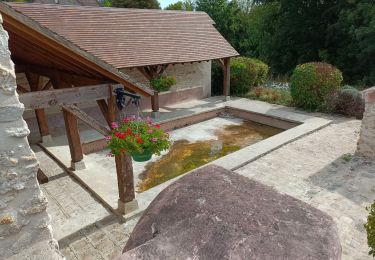
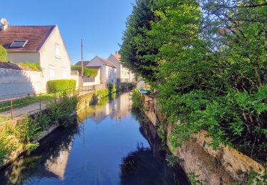
Tocht Stappen Crécy-la-Chapelle - D_CRECY-la-CHAPELLE_RandoCanoé_8Km - Photo

D_CRECY-la-CHAPELLE_RandoCanoé_8Km

 GR77LP
GR77LP

Gebruiker

© OpenStreetMap contributors
Lengte
Lengte
8,8 km
Max. hoogte
Max. hoogte
111 m
Positief hoogteverschil
152 m
Km-Effort
Km-Effort  
10,7 km
Min. hoogte
Min. hoogte
48 m
Negatief hoogteverschil
134 m
Boucle
Boucle
Neen
Datum van aanmaak :
2019-03-04 12:59:26.941
Laatste wijziging :
2019-04-08 08:48:50.468

(0 Bericht)

Stappen
Stappen
2h24
Moeilijkheid : Gemakkelijk

Scan deze QR-code om de tocht te openen in de SityTrail-applicatie

Gratisgps-wandelapplicatie

Logo SityTrail SityTrail

IGN / Geografische instituten

SityTrail uit de App Store downloaden SityTrail uit Google Play downloaden

Logo SityTrail SityTrail World

De wereld gaat voor u open

SityTrail uit de App Store downloaden SityTrail uit Google Play downloaden SityTrail op Huawei AppGallery downloaden

Over ons

Tocht Stappen van 8,8 km beschikbaar op Île-de-France, Seine-et-Marne, Crécy-la-Chapelle. Deze tocht wordt voorgesteld door GR77LP.

Beschrijving

https://www.goelerando.fr/
DAMMARTIN en GOELE 77

RANDO/CANOE SUR LE GRAND MORIN
Le matin 8 Km sur le GR1 au départ de CRECY-LA-CHAPELLE
Le midi repas sorti du sac à GUERARD
L'après midi retour en canoë sur le Grand Morin vers CRECY-LA-CHAPELLE
Carte IGN : 2514 O
Contact :
CANOE-ADVENTURE-0664170400

Hoogteprofiel

Foto's

POI's

POI Guérard - Pique-nique - Photo
GR77LP
GUÉRARD 
POI Guérard - Canoé Départ - Photo
GR77LP
GUÉRARD 
POI Guérard - Canoé - Photo
GR77LP
GUÉRARD 
POI Guérard - Canoé - Photo
GR77LP
GUÉRARD 
POI Guérard - Canoé - Photo
GR77LP
GUÉRARD 
POI Dammartin-sur-Tigeaux - Canoé - Photo
GR77LP
DAMMARTIN-SUR-TIGEAUX 
POI Dammartin-sur-Tigeaux - Canoé - Photo
GR77LP
DAMMARTIN-SUR-TIGEAUX 
POI Tigeaux - Canoé - Photo
GR77LP
TIGEAUX 
POI Tigeaux - Canoé - Photo
GR77LP
TIGEAUX 
POI Voulangis - Canoé - Photo
GR77LP
VOULANGIS 
POI Crécy-la-Chapelle - Canoé - Photo
GR77LP
CRÉCY-LA-CHAPELLE 
POI Crécy-la-Chapelle - Canoé - Photo
GR77LP
CRÉCY-LA-CHAPELLE 
POI Crécy-la-Chapelle - Canoé - Photo
GR77LP
CRÉCY-LA-CHAPELLE 
POI Crécy-la-Chapelle - Canoé - Photo
GR77LP
CRÉCY-LA-CHAPELLE 
POI Crécy-la-Chapelle - Canoé - Photo
GR77LP
CRÉCY-LA-CHAPELLE 

Plaatsbepaling

Land:
France
Regio :
Île-de-France
Departement/Provincie :
Seine-et-Marne
Gemeente :
Crécy-la-Chapelle
Locatie:
Unknown
Vertrek:(Dec)
Vertrek:(UTM)
493112 ; 5411437 (31U) N.

Wandeltochten in de omgeving

Tocht Stappen Crécy-la-Chapelle - Crécy la Chapelle Parcours normal - Photo
Stappen
CC.RIDER

Stappen

Gemakkelijk
(1)
Crécy-la-Chapelle, Île-de-France, Seine-et-Marne, France
16,1 km | 19,5 km-effort
4h 18min
Ja
Tocht Stappen Crécy-la-Chapelle - Crécy la chapelle - Photo
Stappen
CC.RIDER

Stappen

Gemakkelijk
(2)
Crécy-la-Chapelle, Île-de-France, Seine-et-Marne, France
19,7 km | 24 km-effort
5h 12min
Ja
Tocht Stappen Crécy-la-Chapelle - Crécy la Chapelle - Photo
Stappen
jctinchebray

Stappen

Medium
(1)
Crécy-la-Chapelle, Île-de-France, Seine-et-Marne, France
16,4 km | 20 km-effort
4h 23min
Ja
Tocht Stappen Crécy-la-Chapelle - Autour de Tigeaux - Photo
Stappen
em77

Stappen

Medium
(2)
Crécy-la-Chapelle, Île-de-France, Seine-et-Marne, France
13,2 km | 16,5 km-effort
2h 37min
Ja
Tocht Stappen Voulangis - Voulangis - Crécy - Villiers lqqm - Photo
Stappen
Tournan

Stappen

Moeilijk
(1)
Voulangis, Île-de-France, Seine-et-Marne, France
12,9 km | 15,7 km-effort
3h 34min
Ja
Tocht Stappen Voulangis - Voulangis - Crécy - Villiers - Photo
Stappen
Tournan

Stappen

Moeilijk
(1)
Voulangis, Île-de-France, Seine-et-Marne, France
12,9 km | 15,7 km-effort
3h 34min
Ja
Tocht Stappen Guérard - Guérard  - Photo
Stappen
pikibangi

Stappen

Moeilijk
Guérard, Île-de-France, Seine-et-Marne, France
15,4 km | 18,5 km-effort
4h 3min
Ja
Tocht Stappen Crécy-la-Chapelle - Boucle 28 km autour de Crecy la Chapelle - Guérard - Voulangis - Tigeaux - Photo
Stappen
chessyca

Stappen

Medium
Crécy-la-Chapelle, Île-de-France, Seine-et-Marne, France
28 km | 35 km-effort
5h 46min
Ja
Tocht Stappen Tigeaux - Tigeaux - Photo
Stappen
Tournan

Stappen

Medium
(1)
Tigeaux, Île-de-France, Seine-et-Marne, France
19,1 km | 24 km-effort
5h 24min
Ja


Sluiten
Mijn abonnementen