


Hilsen Hilsenfirst Rothenbrunnen Hilsen

staubalex
Gebruiker
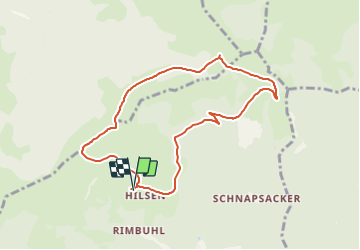

Lengte
7,8 km

Max. hoogte
1222 m

Positief hoogteverschil
344 m
Km-Effort
12,4 km

Min. hoogte
907 m

Negatief hoogteverschil
351 m
Boucle
Ja
Datum van aanmaak :
2018-04-17 19:40:23.375
Laatste wijziging :
2018-04-17 19:40:23.375
2h48
Moeilijkheid : Medium

Gratisgps-wandelapplicatie
 SityTrail
IGN / Geografische instituten
SityTrail Plus
De wereld gaat voor u open
Over ons
Tocht Sneeuwschoenen van 7,8 km beschikbaar op Grand Est, Haut-Rhin, Linthal. Deze tocht wordt voorgesteld door staubalex.
Plaatsbepaling
Land:
France
Regio :
Grand Est
Departement/Provincie :
Haut-Rhin
Gemeente :
Linthal
Locatie:
Unknown
Vertrek:(Dec)
Vertrek:(UTM)
358722 ; 5314152 (32T) N.
Opmerkingen