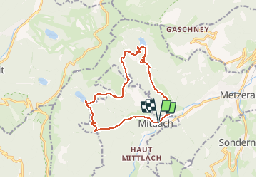
Mittlach, Lac d'Altenweiher, Vallée de la Wormsa

oscar1
Gebruiker

Lengte
12,7 km

Max. hoogte
1088 m

Positief hoogteverschil
635 m
Km-Effort
21 km

Min. hoogte
524 m

Negatief hoogteverschil
636 m
Boucle
Ja
Datum van aanmaak :
2018-04-17 23:53:14.884
Laatste wijziging :
2019-02-09 23:44:15.775
6h00
Moeilijkheid : Onbekend

Gratisgps-wandelapplicatie
 SityTrail
IGN / Geografische instituten
SityTrail Plus
De wereld gaat voor u open
Over ons
Tocht Stappen van 12,7 km beschikbaar op Grand Est, Haut-Rhin, Mittlach. Deze tocht wordt voorgesteld door oscar1.
Beschrijving
Randonnée pour bon marcheur.
Plaatsbepaling
Land:
France
Regio :
Grand Est
Departement/Provincie :
Haut-Rhin
Gemeente :
Mittlach
Locatie:
Unknown
Vertrek:(Dec)
Vertrek:(UTM)
353277 ; 5318634 (32U) N.
Opmerkingen