


sortie vtt du 15042018 dite du lièvre pédaleur!

fabwin
Gebruiker GUIDE
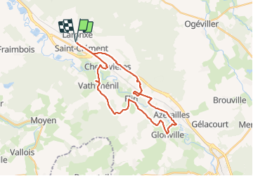

Lengte
28 km

Max. hoogte
311 m

Positief hoogteverschil
303 m
Km-Effort
32 km

Min. hoogte
239 m

Negatief hoogteverschil
303 m
Boucle
Ja
Datum van aanmaak :
2018-04-18 00:36:04.537
Laatste wijziging :
2018-04-18 00:36:04.537
2h07
Moeilijkheid : Medium

Gratisgps-wandelapplicatie
 SityTrail
IGN / Geografische instituten
SityTrail Plus
De wereld gaat voor u open
Over ons
Tocht Mountainbike van 28 km beschikbaar op Grand Est, Meurthe-et-Moselle, Saint-Clément. Deze tocht wordt voorgesteld door fabwin.
Beschrijving
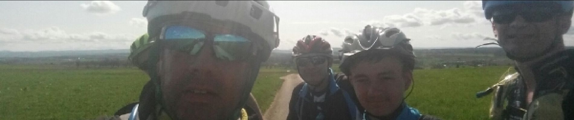
Très belle sortie sous le soleil, avec Jojo, Séb, David & Ange.
Foto's


Plaatsbepaling
Land:
France
Regio :
Grand Est
Departement/Provincie :
Meurthe-et-Moselle
Gemeente :
Saint-Clément
Locatie:
Unknown
Vertrek:(Dec)
Vertrek:(UTM)
323011 ; 5378516 (32U) N.
Opmerkingen