


via rhona j3

ericf64
Gebruiker
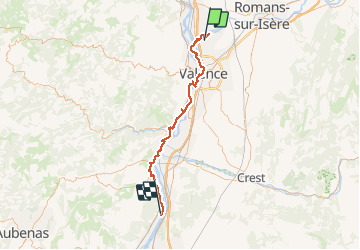

Lengte
67 km

Max. hoogte
137 m

Positief hoogteverschil
397 m
Km-Effort
73 km

Min. hoogte
79 m

Negatief hoogteverschil
434 m
Boucle
Neen
Datum van aanmaak :
2018-06-26 15:15:48.672
Laatste wijziging :
2019-08-30 10:12:30.245
--
Moeilijkheid : Gemakkelijk

Gratisgps-wandelapplicatie
 SityTrail
IGN / Geografische instituten
SityTrail Plus
De wereld gaat voor u open
Over ons
Tocht Fietstoerisme van 67 km beschikbaar op Auvergne-Rhône-Alpes, Drôme, Châteauneuf-sur-Isère. Deze tocht wordt voorgesteld door ericf64.
Beschrijving
camping cruas
Plaatsbepaling
Land:
France
Regio :
Auvergne-Rhône-Alpes
Departement/Provincie :
Drôme
Gemeente :
Châteauneuf-sur-Isère
Locatie:
Unknown
Vertrek:(Dec)
Vertrek:(UTM)
649203 ; 4984404 (31T) N.
Opmerkingen