


2018-06-22 ardechoise

Lucquiaud
Gebruiker

Lengte
112 km

Max. hoogte
1441 m

Positief hoogteverschil
3125 m
Km-Effort
150 km

Min. hoogte
295 m

Negatief hoogteverschil
2110 m
Boucle
Neen
Datum van aanmaak :
2018-09-15 15:02:44.891
Laatste wijziging :
2018-09-15 15:02:44.936
9h34
Moeilijkheid : Zeer moeilijk

Gratisgps-wandelapplicatie
 SityTrail
IGN / Geografische instituten
SityTrail Plus
De wereld gaat voor u open
Over ons
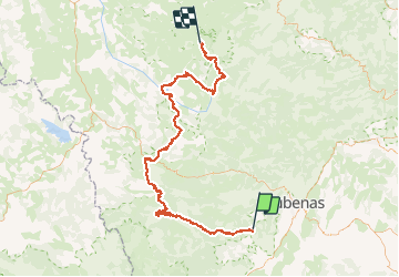
Tocht Fiets van 112 km beschikbaar op Auvergne-Rhône-Alpes, Ardèche, Rocher. Deze tocht wordt voorgesteld door Lucquiaud.
Beschrijving
circuit 3 jours le Tanargue - Lignon
partie 2 Roche / les Estables
Plaatsbepaling
Land:
France
Regio :
Auvergne-Rhône-Alpes
Departement/Provincie :
Ardèche
Gemeente :
Rocher
Locatie:
Unknown
Vertrek:(Dec)
Vertrek:(UTM)
602106 ; 4936454 (31T) N.
Opmerkingen