


Wizernes 15.3 Dén P 213m

alain62rando
Gebruiker
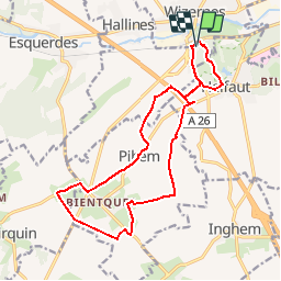

Lengte
15,2 km

Max. hoogte
132 m

Positief hoogteverschil
213 m
Km-Effort
18,1 km

Min. hoogte
27 m

Negatief hoogteverschil
213 m
Boucle
Ja
Datum van aanmaak :
2019-01-11 15:35:44.765
Laatste wijziging :
2019-02-10 15:26:23.182
3h57
Moeilijkheid : Medium

Gratisgps-wandelapplicatie
 SityTrail
IGN / Geografische instituten
SityTrail Plus
De wereld gaat voor u open
Over ons
Tocht Stappen van 15,2 km beschikbaar op Hauts-de-France, Pas-de-Calais, Wizernes. Deze tocht wordt voorgesteld door alain62rando.
Plaatsbepaling
Land:
France
Regio :
Hauts-de-France
Departement/Provincie :
Pas-de-Calais
Gemeente :
Wizernes
Locatie:
Unknown
Vertrek:(Dec)
Vertrek:(UTM)
445702 ; 5617283 (31U) N.
Opmerkingen