Trail Electric bike Bozel - Boucle Moranche - Montfort - Feissons - Photo

Boucle Moranche - Montfort - Feissons

 franquen
franquen

User

© OpenStreetMap contributors
Length
Length
36 km
Max alt
Max alt
1722 m
Uphill gradient
Uphill gradient
1257 m
Km-Effort
Km-Effort  
53 km
Min alt
Min alt
943 m
Downhill gradient
Downhill gradient
1348 m
Boucle
Boucle
No
Creation date :
2020-08-16 08:11:49.311
Updated on :
2020-08-16 15:37:33.969

(0 Reviews)

Electric bike
Electric bike
3h14
Difficulty : Easy

Scan this QR Code to open this trail in the SityTrail application

FREE GPS app for hiking

Logo SityTrail SityTrail

IGN / Geographical institutes

Download SityTrail from the App Store Download SityTrail from Google Play

Logo SityTrail SityTrail World

The world is yours!

Download SityTrail from the App Store Download SityTrail from Google Play Download SityTrail on Huawei AppGallery

About

Trail Electric bike of 36 km to be discovered at Auvergne-Rhône-Alpes, Savoy, Bozel. This trail is proposed by franquen.

Description

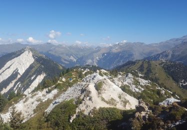
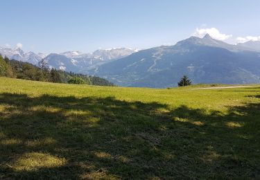
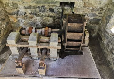
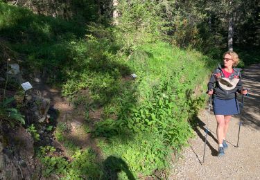
Rando sympa en encorbellemnet et vue sur les  vallées - Moutiers et les sommets.  Ne pas rater la pierre à cupules avant l'arrivée sur Feissons.
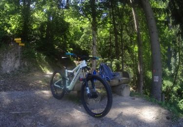
Elevation profile

Positioning

Country:
France
Region :
Auvergne-Rhône-Alpes
Department/Province :
Savoy
Municipality :
Bozel
Location:
Unknown
Start:(UTM)
314468 ; 5035881 (32T) N.

Trails nearby

Trail Mountain bike Bozel - activity_9181659290 (1) - Photo
Mountain bike
GUIDE
pascalou73

Mountain bike

Easy
Bozel, Auvergne-Rhône-Alpes, Savoy, France
9.4 km | 13.8 km-effort
57min
Yes
Trail Walking Bozel - mont de la guerre - Photo
Walking
whisper73

Walking

Easy
(1)
Bozel, Auvergne-Rhône-Alpes, Savoy, France
7.6 km | 21 km-effort
Unknown
No
Trail Walking Bozel - Le Mont Jovet - Bozel - Photo
Walking
tracegps

Walking

Difficult
(1)
Bozel, Auvergne-Rhône-Alpes, Savoy, France
17.3 km | 32 km-effort
4h 45min
Yes
Trail Walking Courchevel - Courchevel-Moriond,  Lac de  la Rosière, col de la Chal, crête du Mont Charvet, col de Grosse Pierre, Cascades des Poux - Photo
Walking
ranchoup

Walking

Difficult
Courchevel, Auvergne-Rhône-Alpes, Savoy, France
12.8 km | 25 km-effort
5h 36min
Yes
Trail Walking Brides-les-Bains - Brides les Bains - Photo
Walking
jema.bernard

Walking

Medium
Brides-les-Bains, Auvergne-Rhône-Alpes, Savoy, France
5.3 km | 8.4 km-effort
1h 25min
Yes
Trail Walking Feissons-sur-Salins - Feissons sur salins  / Bois du sapey - Photo
Walking
ricou1964

Walking

Medium
Feissons-sur-Salins, Auvergne-Rhône-Alpes, Savoy, France
15.2 km | 23 km-effort
4h 2min
Yes
Trail Walking Bozel - Hauteville Montfort - Photo
Walking
franquen

Walking

Difficult
Bozel, Auvergne-Rhône-Alpes, Savoy, France
37 km | 59 km-effort
1h 30min
Yes
Trail Walking Planay - gorges de Ballandaz - Photo
Walking
whisper73

Walking

Easy
(1)
Planay, Auvergne-Rhône-Alpes, Savoy, France
2.8 km | 5.2 km-effort
1h 1min
Yes
Trail Walking Courchevel - Courcheveles crete charbet, petit mont blanc - Photo
Walking
jybe

Walking

Difficult
Courchevel, Auvergne-Rhône-Alpes, Savoy, France
23 km | 43 km-effort
8h 35min
Yes


Close
My subscriptions