


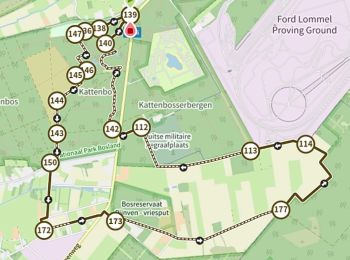
11,4 km | 12,2 km-effort
Lommel : découvrez les meilleures randonnées : 57 pédestres, 8 à vélo ou VTT et 1 parcours équestres. Tous ces circuits, parcours, itinéraires et activités en plein air sont disponibles dans nos applications SityTrail pour smartphones et tablettes.
A pied


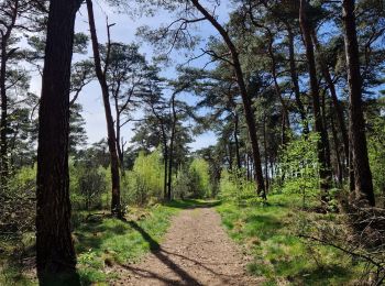
• Bosland is overdadig genieten van verrassende natuur, elke dag weer een beetje anders. Voor kinderen is Bosland één g...
A pied
• Bosland is overdadig genieten van verrassende natuur, elke dag weer een beetje anders. Voor kinderen is Bosland één g...
A pied
• Bosland is overdadig genieten van verrassende natuur, elke dag weer een beetje anders. Voor kinderen is Bosland één g...
A pied
• Randonnée créée par Bosland. Site web: https://www.natuurpunt.be/natuurgebied/buitengoor-de-maat-den-diel
A pied
• Symbole: rectangle
A pied
• Symbole: disk
A pied
• Randonnée créée par Regionaal Landschap Lage Kempen. Symbole: dot
A pied
• Symbole: triangle
A pied
• Randonnée créée par Bosland. Symbole: disk
A pied
• Randonnée créée par Bosland. Symbole: triangle
A pied
• Symbole: disk
Marche
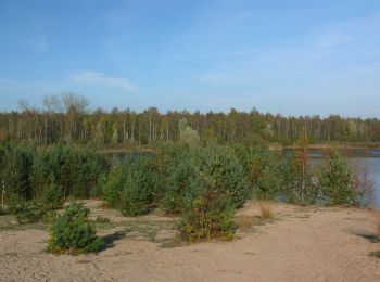
• randonnée en boucle de 13km un doux mélange de chemin boisé pinède et de sable autour de plans d'eau table de pic niq...
Marche
• "Terre forestière enchanteresse" Vous commencez cette visite à pied du Limbourg à l'endroit où se trouvait autrefoi...

Marche
Marche
• Ludique, agréable, belle !
A pied
• Symbole: dragonfly
A pied
• Symbole: triangle
Marche
• 🅿️ Départ et Parking: Le Soeverein, Sportveldenstraat 10 à 3920 Lommel Le panneau des promenades se trouve en face ...
Marche
Marche
20 randonnées affichées sur 67
Application GPS de randonnée GRATUITE
 SityTrail
IGN / Instituts géographiques
SityTrail World
Le monde est à vous