Tocht Stappen Lamanère - Lamanere_PuigDeComaNegra_T - Photo

Lamanere_PuigDeComaNegra_T

 force
force

Gebruiker

© OpenStreetMap contributors
Lengte
Lengte
15,9 km
Max. hoogte
Max. hoogte
1545 m
Positief hoogteverschil
909 m
Km-Effort
Km-Effort  
28 km
Min. hoogte
Min. hoogte
774 m
Negatief hoogteverschil
904 m
Boucle
Boucle
Ja
Datum van aanmaak :
2017-07-13 00:00:00.0
Laatste wijziging :
2017-07-13 00:00:00.0

(1 Bericht)

Stappen
Stappen
5h48
Moeilijkheid : Onbekend

Scan deze QR-code om de tocht te openen in de SityTrail-applicatie

Gratisgps-wandelapplicatie

Logo SityTrail SityTrail

IGN / Geografische instituten

SityTrail uit de App Store downloaden SityTrail uit Google Play downloaden

Logo SityTrail SityTrail World

De wereld gaat voor u open

SityTrail uit de App Store downloaden SityTrail uit Google Play downloaden SityTrail op Huawei AppGallery downloaden

Over ons

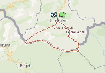
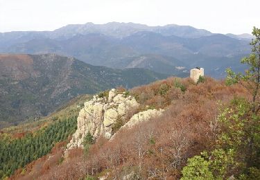
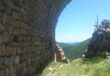
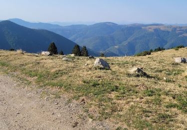
Tocht Stappen van 15,9 km beschikbaar op Occitanië, Pyrénées-Orientales, Lamanère. Deze tocht wordt voorgesteld door force.

Beschrijving

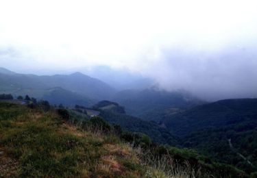
Randonnée mal balisée à partir de la frontière Fr-Es. Vue panoramique au Puig de coma Negra.

Hoogteprofiel

Foto's

POI's

POI Lamanère - Chapelle Ste Christine - Photo
force

Plaatsbepaling

Land:
France
Regio :
Occitanië
Departement/Provincie :
Pyrénées-Orientales
Gemeente :
Lamanère
Locatie:
Unknown
Vertrek:(Dec)
Vertrek:(UTM)
460441 ; 4689817 (31T) N.

Opmerkingen

Gelieve in te loggen om een commentaar of een beoordeling achter te laten


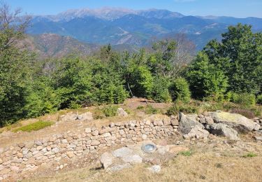
ce circuit suit la frontière


Wandeltochten in de omgeving

Tocht Stappen Lamanère - lamanere-coral_T - Photo
Stappen
force

Stappen

Heel gemakkelijk
Lamanère, Occitanië, Pyrénées-Orientales, France
14,9 km | 25 km-effort
5h 18min
Ja
Tocht Stappen Lamanère - Tours de Cabrens - Photo
Stappen
jcmartin

Stappen

Medium
Lamanère, Occitanië, Pyrénées-Orientales, France
12 km | 19,6 km-effort
4h 14min
Ja
Tocht Stappen Serralongue - serralongue Tours de Cabrens_T - Photo
Stappen
force

Stappen

Medium
Serralongue, Occitanië, Pyrénées-Orientales, France
13,3 km | 22 km-effort
4h 39min
Ja
Tocht Stappen Prats-de-Mollo-la-Preste - 5 et 6 rando sur 2 jours  - Photo
Stappen
ricou1964

Stappen

Zeer moeilijk
Prats-de-Mollo-la-Preste, Occitanië, Pyrénées-Orientales, France
32 km | 49 km-effort
9h 39min
Ja
Tocht Stappen Lamanère - Lamanere - Photo
Stappen
jcmartin

Stappen

Medium
Lamanère, Occitanië, Pyrénées-Orientales, France
16,4 km | 26 km-effort
5h 20min
Ja
Tocht Mountainbike Prats-de-Mollo-la-Preste - Espace VTT FFC Haut Vallespir - circuit n° 17 - Raid Transfrontalier - Photo
Mountainbike
tracegps

Mountainbike

Zeer moeilijk
Prats-de-Mollo-la-Preste, Occitanië, Pyrénées-Orientales, France
41 km | 64 km-effort
4h 30min
Ja
Tocht Mountainbike Serralongue - Espace VTT FFC Haut Vallespir - circuit n° 11 - De Serralongue à Falgos - Photo
Mountainbike
tracegps

Mountainbike

Moeilijk
Serralongue, Occitanië, Pyrénées-Orientales, France
28 km | 39 km-effort
2h 30min
Ja
Tocht Mountainbike Prats-de-Mollo-la-Preste - Espace VTT FFC Haut Vallespir - circuit n° 3 - La Chapelle Ste Marguerite de Prats de Mollo - Photo
Mountainbike
tracegps

Mountainbike

Gemakkelijk
Prats-de-Mollo-la-Preste, Occitanië, Pyrénées-Orientales, France
12,6 km | 17 km-effort
1h 15min
Ja
Tocht Stappen Lamanère - 2 - Photo
Stappen
ricou1964

Stappen

Moeilijk
Lamanère, Occitanië, Pyrénées-Orientales, France
16,7 km | 27 km-effort
5h 2min
Ja


Sluiten
Mijn abonnementen