Tour Wandern Freissinières - Via Alpina - R130: Freissinières > Mont-Dauphin (Guillestre) - Photo

Via Alpina - R130: Freissinières > Mont-Dauphin (Guillestre)

 tracegps
tracegps

Benutzer

© OpenStreetMap contributors
Länge
Länge
25 km
Maximale Höhe
Maximale Höhe
1600 m
Positive Höhendifferenz
857 m
Km-Effort
Km-Effort  
37 km
Min. Höhe
Min. Höhe
881 m
Negative Höhendifferenz
1033 m
Boucle
Boucle
Nein
Erstellungsdatum :
2014-12-10 00:00:00.0
Letzte Änderung :
2014-12-10 00:00:00.0

(0 Nachricht)

Wandern
Wandern
7h25
Schwierigkeit : Sehr schwierig

Scannen Sie diesen QR-Code, um die Tour in der SityTrail-Anwendung zu öffnen

Kostenlosegpshiking-Anwendung

Logo SityTrail SityTrail

IGN / Geografische Institute

SityTrail aus dem App Store herunterladen SityTrail von Google Play herunterladen

Logo SityTrail SityTrail World

Die Welt öffnet sich für Sie

SityTrail aus dem App Store herunterladen SityTrail von Google Play herunterladen SityTrail auf Huawei AppGallery herunterladen

Über SityTrail

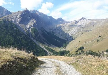
Tour Wandern von 25 km verfügbar auf Provence-Alpes-Côte d'Azur, Hochalpen, Freissinières. Diese Tour wird von tracegps vorgeschlagen.

Beschreibung

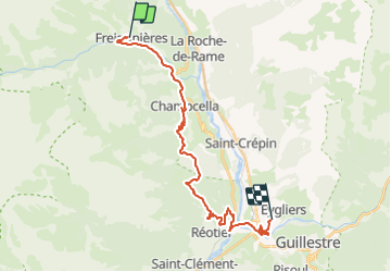
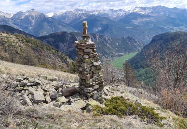
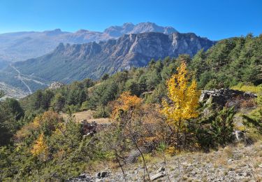
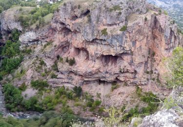
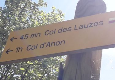
Via Alpina - R130: Freissinières > Mont-Dauphin (Guillestre). Cette étape quitte Freissinières en suivant le GR 50 et traverse plusieurs hameaux de montagne. Puis elle traverse le bois des Fonds du Sap pour descendre à proximité du village de Réotier et sa fontaine pétrifiante, et rejoindre la large vallée de la Durance. Peu après la confluence des rivières du Guil et de la Durance, elle rejoint la place-forte de Mont-Dauphin, point d’étape. Randonnée alpine (passage équipé ou très exposé, névé, blocs). Description complète de l’étape sur Via-Alpina.org.

Höhenprofil

Foto-Galerie

Ort

Land:
France
Region :
Provence-Alpes-Côte d'Azur
Abteilung/Provinz :
Hochalpen
Kommune :
Freissinières
Standort:
Unknown
Gehen Sie:(Dec)
Gehen Sie:(UTM)
305046 ; 4958591 (32T) N.

Touren in der Umgebung

Tour Wandern Freissinières - crête en bordure vallée Freissinieres - Photo
Wandern
gildascb

Wandern

Medium
(2)
Freissinières, Provence-Alpes-Côte d'Azur, Hochalpen, France
14,7 km | 26 km-effort
4h 52min
Ja
Tour Wandern Champcella - Gouffre de Gourfouran - Photo
Wandern
CYCLOHC

Wandern

Einfach
(2)
Champcella, Provence-Alpes-Côte d'Azur, Hochalpen, France
5,1 km | 8,1 km-effort
2h 2min
Ja
Tour Wandern Champcella - FRESSINIERES - SEYES 16.3KM - Photo
Wandern
jpb83

Wandern

Medium
(1)
Champcella, Provence-Alpes-Côte d'Azur, Hochalpen, France
16,3 km | 28 km-effort
5h 44min
Ja
Tour Mountainbike Freissinières - traversée fressiniere reotier - Photo
Mountainbike
tchoua

Mountainbike

Schwierig
Freissinières, Provence-Alpes-Côte d'Azur, Hochalpen, France
36 km | 52 km-effort
3h 32min
Ja
Tour Wandern Freissinières - tour de fressiniere - Photo
Wandern
tchoua

Wandern

Medium
Freissinières, Provence-Alpes-Côte d'Azur, Hochalpen, France
25 km | 43 km-effort
6h 16min
Ja
Tour Wandern La Roche-de-Rame - la grande barre par cabane des aiguilles  - Photo
Wandern
tchoua

Wandern

Sehr schwierig
La Roche-de-Rame, Provence-Alpes-Côte d'Azur, Hochalpen, France
13,7 km | 27 km-effort
3h 34min
Ja
Tour Wandern Champcella - 2020-09-10 Balade Gouffre du Gourfouran - Photo
Wandern
GUIDE
holtzv

Wandern

Sehr leicht
Champcella, Provence-Alpes-Côte d'Azur, Hochalpen, France
4,8 km | 7,8 km-effort
1h 14min
Ja
Tour Wandern Freissinières - Fressiniere  les Roberts  Lac de la Lauze - Photo
Wandern
Sorriaux

Wandern

Medium
Freissinières, Provence-Alpes-Côte d'Azur, Hochalpen, France
13,9 km | 22 km-effort
4h 12min
Ja
Tour Wandern Freissinières - col de val-haute - Photo
Wandern
gildascb

Wandern

Einfach
Freissinières, Provence-Alpes-Côte d'Azur, Hochalpen, France
7,1 km | 13,5 km-effort
2h 52min
Ja


Schließen
Meine Abonnements