Tour Zu Fuß Gaillefontaine - Sur les hauteurs de Gaillefontaine - Photo

Sur les hauteurs de Gaillefontaine

 sebcar
sebcar

Benutzer

© OpenStreetMap contributors
Länge
Länge
11,2 km
Maximale Höhe
Maximale Höhe
246 m
Positive Höhendifferenz
156 m
Km-Effort
Km-Effort  
13,2 km
Min. Höhe
Min. Höhe
169 m
Negative Höhendifferenz
156 m
Boucle
Boucle
Ja
Erstellungsdatum :
2019-08-24 14:44:12.746
Letzte Änderung :
2019-08-24 14:47:43.184

(0 Nachricht)

Zu Fuß
Zu Fuß
--
Schwierigkeit : Sehr leicht

Scannen Sie diesen QR-Code, um die Tour in der SityTrail-Anwendung zu öffnen

Kostenlosegpshiking-Anwendung

Logo SityTrail SityTrail

IGN / Geografische Institute

SityTrail aus dem App Store herunterladen SityTrail von Google Play herunterladen

Logo SityTrail SityTrail World

Die Welt öffnet sich für Sie

SityTrail aus dem App Store herunterladen SityTrail von Google Play herunterladen SityTrail auf Huawei AppGallery herunterladen

Über SityTrail

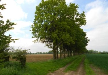
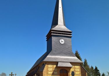
Tour Zu Fuß von 11,2 km verfügbar auf Normandie, Seine-Maritime, Gaillefontaine. Diese Tour wird von sebcar vorgeschlagen.

Höhenprofil

POIs

POI Gaillefontaine - Place de la Mairie - Photo
sebcar
GAILLEFONTAINE 
POI Gaillefontaine - D919 - Photo
sebcar
GAILLEFONTAINE 
POI Gaillefontaine - Allée de France - Photo
sebcar
GAILLEFONTAINE 
POI Haucourt - Impasse du Clos Cagnard - Photo
sebcar
POI Haucourt - D129 Pont SNCF - Photo
sebcar
HAUCOURT 
POI Gaillefontaine - D135 - Photo
sebcar
GAILLEFONTAINE 
POI Gaillefontaine - À gauche le Chemin Saint-Christophe - Photo
sebcar
POI Gaillefontaine - Croisement pour l'aller et le retour - Photo
sebcar
POI Gaillefontaine - Route de la chaussée d'Amiens - Photo
sebcar
POI Gaillefontaine - Chemin du château d'eau - Photo
sebcar
GAILLEFONTAINE 
POI Gaillefontaine - Rue aux Juifs - Photo
sebcar
GAILLEFONTAINE 
POI Gaillefontaine - Place de la Mairie - Photo
sebcar
GAILLEFONTAINE 

Ort

Land:
France
Region :
Normandie
Abteilung/Provinz :
Seine-Maritime
Kommune :
Gaillefontaine
Standort:
Unknown
Gehen Sie:(UTM)
399996 ; 5501017 (31U) N.

Touren in der Umgebung

Tour Pferd Conteville - La Hallegouche (N° 7) - Conteville - Photo
Pferd
tracegps

Pferd

Einfach
Conteville, Normandie, Seine-Maritime, France
10,9 km | 11,6 km-effort
1h 30min
Ja
Tour Mountainbike Conteville - La Hallegouche (N° 7) - Conteville - Photo
Mountainbike
tracegps

Mountainbike

Einfach
Conteville, Normandie, Seine-Maritime, France
10,9 km | 11,6 km-effort
1h 0min
Ja
Tour Wandern Conteville - La Hallegouche (N° 7) - Conteville - Photo
Wandern
tracegps

Wandern

Medium
Conteville, Normandie, Seine-Maritime, France
10,9 km | 11,6 km-effort
2h 45min
Ja
Tour Zu Fuß Conteville - Le Hallegouche - Photo
Zu Fuß
PRO

Zu Fuß

Einfach
Conteville, Normandie, Seine-Maritime, France
10,1 km | 10,8 km-effort
2h 27min
Ja
Tour Fahrrad Forges-les-Eaux - Boucle Bézu St Eloi via Forges-les-Eaux - Photo
Fahrrad
alaindurbecq

Fahrrad

Medium
Forges-les-Eaux, Normandie, Seine-Maritime, France
120 km | 136 km-effort
12h 0min
Ja
Tour Zu Fuß Gaillefontaine - gaillefontaine - Photo
Zu Fuß
patoches76

Zu Fuß

Einfach
Gaillefontaine, Normandie, Seine-Maritime, France
9,5 km | 11 km-effort
2h 29min
Ja
Tour Zu Fuß Forges-les-Eaux - Forges les eaux 2 - Photo
Zu Fuß
maillebreze

Zu Fuß

Medium
Forges-les-Eaux, Normandie, Seine-Maritime, France
12,9 km | 14,8 km-effort
3h 0min
Ja
Tour Zu Fuß Forges-les-Eaux - forges les eaux - Photo
Zu Fuß
maillebreze

Zu Fuß

Medium
Forges-les-Eaux, Normandie, Seine-Maritime, France
9,1 km | 10,3 km-effort
3h 20min
Ja
Tour Zu Fuß Gaillefontaine - Saint Maurice - Photo
Zu Fuß
sebcar

Zu Fuß

Einfach
Gaillefontaine, Normandie, Seine-Maritime, France
8,8 km | 11 km-effort
Unbekannt
Ja


Schließen
Meine Abonnements