


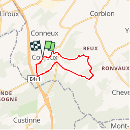


5 km | 6,5 km-effort


Destination Condroz-Famenne- une nature préservée PRO


Kostenlosegpshiking-Anwendung
 SityTrail
IGN / Geografische Institute
SityTrail World
Die Welt öffnet sich für Sie
Tour Wandern von 8,5 km verfügbar auf Wallonien, Namur, Ciney. Diese Tour wird von Vallées des Saveurs - Maison du Tourisme Condroz-Famenne vorgeschlagen.
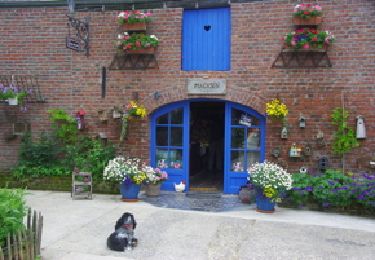
Les incontournables:
- Les grottes de Conjoux
- Le Tilleul de Conjoux


Wandern
Wandern

Wandern

Wandern

Wandern

Wandern
Wandern

Wandern

Wandern
belle balade mais boueuse
Fijne wandeling, aanrader. Stevige klimmetjes en afdalingen, en modderig bij nat weer.
beau parcours et très bien fléché malgré une petite erreur au moment de traverser une prairie.
Magnifique. Très varié
belle promenade de 9km balise rectangle vert un vrai plaisir de découverte en découverte à faire