


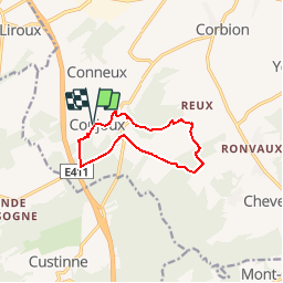


5 km | 6,5 km-effort


Destination Condroz-Famenne- une nature préservée PRO


Application GPS de randonnée GRATUITE
 SityTrail
IGN / Instituts géographiques
SityTrail World
Le monde est à vous
Randonnée Marche de 8,5 km à découvrir à Wallonie, Namur, Ciney. Cette randonnée est proposée par Vallées des Saveurs - Maison du Tourisme Condroz-Famenne.
Les incontournables:
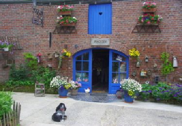
- Les grottes de Conjoux
- Le Tilleul de Conjoux


Marche
Marche

Marche

Marche

Marche

Marche
Marche
Marche

Marche
belle balade mais boueuse
Fijne wandeling, aanrader. Stevige klimmetjes en afdalingen, en modderig bij nat weer.
beau parcours et très bien fléché malgré une petite erreur au moment de traverser une prairie.
Magnifique. Très varié
belle promenade de 9km balise rectangle vert un vrai plaisir de découverte en découverte à faire