![](/images/other/stat-length.png)
![Tour Wandern Doische - Balade de Doische à Foisches - Photo](https://media.geolcdn.com/t/1900/400/ext.pjpeg?maxdim=2&url=https%3A%2F%2Fmedia.geolcdn.com%2Ff%2Ff8b30e3a-39db-421e-94ed-d41213e0167d.jpeg)
Balade de Doische à Foisches
Desrumaux
Benutzer GUIDE
![Länge](/images/other/stat-length.png)
Länge
9,9 km
![Maximale Höhe](https://static1.geolcdn.com/siteimages/upload/files/1508320355ic_sort_altitude_max_24dp.png)
Maximale Höhe
223 m
![Positive Höhendifferenz](https://static1.geolcdn.com/siteimages/upload/files/1508320355ic_sort_den_pos_24dp.png)
Positive Höhendifferenz
195 m
![Km-Effort](/images/other/stat-length.png)
Km-Effort
12,5 km
![Min. Höhe](https://static1.geolcdn.com/siteimages/upload/files/1508320355ic_sort_altitude_min_24dp.png)
Min. Höhe
142 m
![Negative Höhendifferenz](https://static1.geolcdn.com/siteimages/upload/files/1508320355ic_sort_den_neg_24dp.png)
Negative Höhendifferenz
189 m
![Boucle](https://static1.geolcdn.com/siteimages/upload/files/16400158638029165_repeat_loop_refresh_sync_direction_icon.png)
Boucle
Ja
Erstellungsdatum :
2024-04-08 15:32:35.247
Letzte Änderung :
2024-04-10 05:41:19.68
![Wandern](https://static1.geolcdn.com/sitytour/trail-icons/101.png)
2h49
Schwierigkeit : Schwierig
![Scannen Sie diesen QR-Code, um die Tour in der SityTrail-Anwendung zu öffnen](https://capi.geolives.com/qq0zvz2zws4bq2lad0pu/sitytour/trails/4009254/qr.png?size=200)
Kostenlosegpshiking-Anwendung
Über SityTrail
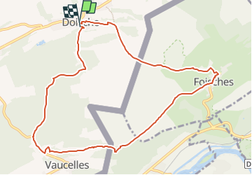
Tour Wandern von 9,9 km verfügbar auf Wallonien, Namur, Doische. Diese Tour wird von Desrumaux vorgeschlagen.
Beschreibung
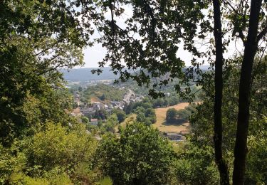
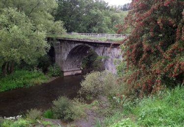
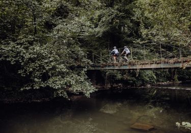
Jolie balade transfrontalière au départ du village de Doische en province de Namur vers le village de Foisches situé dans le département des Ardennes française région Grand Est.
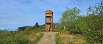
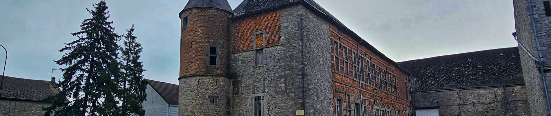
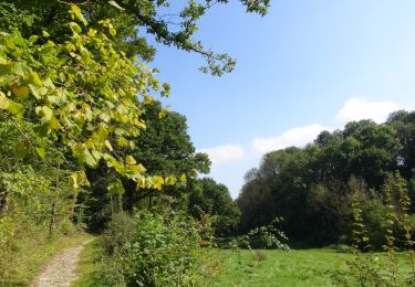
Ort
Land:
Belgium
Region :
Wallonien
Abteilung/Provinz :
Namur
Kommune :
Doische
Standort:
Unknown
Gehen Sie:(Dec)
Gehen Sie:(UTM)
624739 ; 5555173 (31U) N.
Kommentare
Touren in der Umgebung
![Tour Wandern Viroinval - Mazée, sur le sentier des Douaniers - Photo](https://media.geolcdn.com/t/375/260/ext.jpg?maxdim=2&url=https%3A%2F%2Fmedia.geolcdn.com%2Ff%2Fe6a3fc86-55fd-4ddf-a6e6-df3228867288.jpg)
![Wandern Wandern](https://static1.geolcdn.com/sitytour/trail-icons/101.png)
Mazée, sur le sentier des Douaniers
Wandern
Sehr leicht
(1)
Viroinval,
Wallonien,
Namur,
Belgium
![](/images/other/stat-length.png)
7,6 km | 10,5 km-effort
4h 2min
![](https://static1.geolcdn.com/siteimages/upload/files/16400158638029165_repeat_loop_refresh_sync_direction_icon.png)
Ja
![Tour Wandern Doische - Promenade à Vodelée - Photo](https://media.geolcdn.com/t/375/260/ext.jpg?maxdim=2&url=https%3A%2F%2Fstatic1.geolcdn.com%2Fsiteimages%2Fupload%2Ffiles%2F1553511878bg_sport_marche.png)
![Wandern Wandern](https://static1.geolcdn.com/sitytour/trail-icons/101.png)
Promenade à Vodelée
Wandern
Einfach
(1)
Doische,
Wallonien,
Namur,
Belgium
![](/images/other/stat-length.png)
9,3 km | 11,4 km-effort
2h 15min
![](https://static1.geolcdn.com/siteimages/upload/files/16400158638029165_repeat_loop_refresh_sync_direction_icon.png)
Ja
![Tour Wandern Doische - Enregistré le 1 mars 2023 10:37:39 - Photo](https://media.geolcdn.com/t/375/260/ext.jpg?maxdim=2&url=https%3A%2F%2Fmedia.geolcdn.com%2Ff%2Fff0fe14c-ce13-470d-811d-574f23709db3.JPG)
![Wandern Wandern](https://static1.geolcdn.com/sitytour/trail-icons/101.png)
Enregistré le 1 mars 2023 10:37:39
Wandern
Medium
(1)
Doische,
Wallonien,
Namur,
Belgium
![](/images/other/stat-length.png)
6,7 km | 8,7 km-effort
1h 58min
![](https://static1.geolcdn.com/siteimages/upload/files/16400158638029165_repeat_loop_refresh_sync_direction_icon.png)
Ja
![Tour Zu Fuß Viroinval - Les Bornes Frontières - Photo](https://media.geolcdn.com/t/375/260/ext.jpg?maxdim=2&url=https%3A%2F%2Fmedia.geolcdn.com%2Ff%2Fa6892793-3234-43c9-80be-7bf10bbac001.jpeg)
![Zu Fuß Zu Fuß](https://static1.geolcdn.com/sitytour/trail-icons/100.png)
Les Bornes Frontières
Zu Fuß
Einfach
Viroinval,
Wallonien,
Namur,
Belgium
![](/images/other/stat-length.png)
7 km | 9,8 km-effort
2h 13min
![](https://static1.geolcdn.com/siteimages/upload/files/16400158638029165_repeat_loop_refresh_sync_direction_icon.png)
Ja
![Tour Zu Fuß Viroinval - Les Cretes - Photo](https://media.geolcdn.com/t/375/260/ext.jpg?maxdim=2&url=https%3A%2F%2Fmedia.geolcdn.com%2Ff%2F221f0727-a012-4ae6-877e-1027f257bee5.jpeg)
![Zu Fuß Zu Fuß](https://static1.geolcdn.com/sitytour/trail-icons/100.png)
![Tour Zu Fuß Viroinval - Bornes Frontières - Photo](https://media.geolcdn.com/t/375/260/ext.jpg?maxdim=2&url=https%3A%2F%2Fpivotmedia.tourismewallonie.be%2FOTH-A0-004E-2ENI%2FOTH-A0-004E-2ENI.jpg)
![Zu Fuß Zu Fuß](https://static1.geolcdn.com/sitytour/trail-icons/100.png)
Bornes Frontières
Zu Fuß
Einfach
Viroinval,
Wallonien,
Namur,
Belgium
![](/images/other/stat-length.png)
7 km | 9,5 km-effort
2h 9min
![](https://static1.geolcdn.com/siteimages/upload/files/16400158638029165_repeat_loop_refresh_sync_direction_icon.png)
Ja
![Tour Mountainbike Philippeville - Boucle de l'Hermeton - Photo](https://media.geolcdn.com/t/375/260/ext.jpg?maxdim=2&url=https%3A%2F%2Fpivotmedia.tourismewallonie.be%2FOTH-A0-004F-1Z18%2FOTH-A0-004F-1Z18.jpg)
![Mountainbike Mountainbike](https://static1.geolcdn.com/sitytour/trail-icons/202.png)
Boucle de l'Hermeton
Mountainbike
Medium
Philippeville,
Wallonien,
Namur,
Belgium
![](/images/other/stat-length.png)
21 km | 25 km-effort
1h 46min
![](https://static1.geolcdn.com/siteimages/upload/files/16400158638029165_repeat_loop_refresh_sync_direction_icon.png)
Ja
![Tour Zu Fuß Doische - Balade de Doische àVaucelles - Photo](https://media.geolcdn.com/t/375/260/ext.jpg?maxdim=2&url=https%3A%2F%2Fmedia.geolcdn.com%2Ff%2Ffaa46946-182d-4874-9e61-93a8355b7f40.jpg)
![Zu Fuß Zu Fuß](https://static1.geolcdn.com/sitytour/trail-icons/100.png)
Balade de Doische àVaucelles
Zu Fuß
Sehr leicht
Doische,
Wallonien,
Namur,
Belgium
![](/images/other/stat-length.png)
10,1 km | 12,3 km-effort
Unbekannt
![](https://static1.geolcdn.com/siteimages/upload/files/16400158638029165_repeat_loop_refresh_sync_direction_icon.png)
Ja
![Tour Wandern Philippeville - Balade à Romedenne - Photo](https://media.geolcdn.com/t/375/260/ext.jpg?maxdim=2&url=https%3A%2F%2Fservices.sitytrail.com%2FGeolivesWS%2FDownloadMedia.ashx%3FTrailID%3D345425%26Media%3D106f32a9-ca33-40d7-84b1-7c4d97013f80.JPG)
![Wandern Wandern](https://static1.geolcdn.com/sitytour/trail-icons/101.png)
Balade à Romedenne
Wandern
Einfach
(1)
Philippeville,
Wallonien,
Namur,
Belgium
![](/images/other/stat-length.png)
7,8 km | 9,4 km-effort
2h 2min
![](https://static1.geolcdn.com/siteimages/upload/files/16400158638029165_repeat_loop_refresh_sync_direction_icon.png)
Ja