


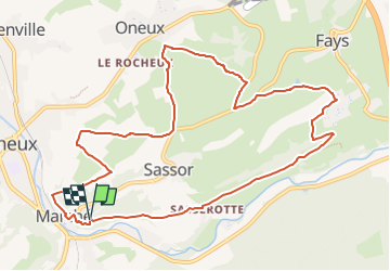


12,7 km | 16,8 km-effort


Randonnez sur et autour des GR ® wallons (Sentiers de Grande Randonnée). PRO


Kostenlosegpshiking-Anwendung
 SityTrail
IGN / Geografische Institute
SityTrail World
Die Welt öffnet sich für Sie
Tour Wandern von 10,8 km verfügbar auf Wallonien, Lüttich, Theux. Diese Tour wird von GR Rando vorgeschlagen.
RF-LG-08 - De crête en crête autour du château fort de Franchimont.
Dans quel type de paysage randonnons-nous?
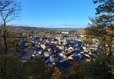
Nous allons nous promener dans un paysage de bocage, c’est-à-dire dans une région où les champs et les prés sont entourés de haies ou de rangées d’arbres (ou, souvent aussi, hélas, de simples clôtures de fils barbelés !) qui marquent les limites de parcelles de tailles inégales et de formes différentes. L‘habitat y est généralement dispersé en fermes et en hameaux. La balade va nous conduire par monts et par vaux, de sommet en sommet.
Quelle difficulté ?
Quelques côtes un peu ardues dans la première partie du parcours.
Combien de kilomètres ?
10,9 km.
Sur quel GR randonnons-nous ?
Nous allons commencer par suivre le GR 573 «Vesdre – Hoëgne – Helle et Hautes Fagnes», l’abandonner pour le retrouver en fin de parcours.
Où démarrons-nous ?
Sur le parking du château de Franchimont (carte Michelin n° 534, pli U/19).
Comment y arriver ?
Sur la N62 (Beaufays – Theux – Spa), traverser, dans l’entité de Theux, le pont en direction de Sassor, à hauteur de l’institut Saint-Roch (grand bâtiment en briques rouges). Des panneaux touristiques, lettres blanches sur fond brun, balisent l’accès au site.
Que découvrons-nous aujourd’hui ?
À l’issue de cette balade, nous visiterons les ruines du château de Franchimont.
Quelles sont les cartes IGN de référence ?
Cartes IGN au 1: 20 000 : «Aywaille – Spa», 49/3-4 et «Fléron – Verviers», 42/7-8.
Transports en commun ?
À 100 mètres de la route à proximité de l’institut Saint-Roch, traversée 600 mètres après le début de la randonnée : SNCB, ligne 44 Gare de Franchimont ; Bus TEC n° 388 Verviers – Theux – Spa : arrêt «Theux - Saint- Roch» (services nombreux).

Wandern

Wandern


Fahrrad
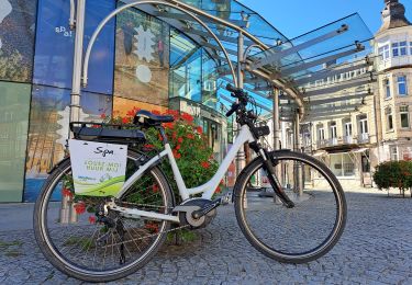
Elektrofahrrad
Wandern
Zu Fuß
Zu Fuß
Wandern
70.836
Prachtige wandeling met vele weidse uitzichten. Heel afwisselend: bos, weiden, akkers.