Alex, Upper Savoy, On foot: Best trails, routes and walks

1 comments

Alex: Discover the best trails: 23 walking and 1 trail. All these trails, routes and outdoor activities are available in our SityTrail applications for smartphones and tablets.


The best trails (24)
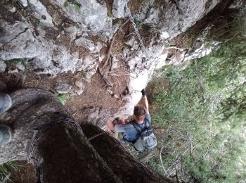
Trail Walking Alex - trou de la chapelle (Alex) - Photo
Walking 8.272
Km

Walking

Medium
Alex, Auvergne-Rhône-Alpes, Upper Savoy, France
8.3 km | 19.8 km-effort
4h 20min
865 m
868 m
Yes
nadd73

Trail Walking Alex - alex - Photo
Walking 23.072
Km

Walking

Medium
Alex, Auvergne-Rhône-Alpes, Upper Savoy, France
23 km | 37 km-effort
7h 9min
996 m
1079 m
No
Bugeat

Trail Walking Alex - alex - Photo
Walking 18.28
Km

Walking

Very difficult
Alex, Auvergne-Rhône-Alpes, Upper Savoy, France
18.3 km | 30 km-effort
6h 56min
856 m
854 m
Yes
Bugeat

Trail Walking Alex - alex - Photo
Walking 15.36
Km

Walking

Difficult
Alex, Auvergne-Rhône-Alpes, Upper Savoy, France
15.4 km | 18 km-effort
5h 55min
196 m
195 m
No
Bugeat

Trail Walking Alex - Trou de La Chapelle - Photo
Walking 15.872
Km

Walking

Alex, Auvergne-Rhône-Alpes, Upper Savoy, France
15.9 km | 36 km-effort
6h 35min
1509 m
1509 m
Yes
Chabard

Trail Walking Alex - 73 trou chapelle - Photo
Walking 12.464
Km

Walking

Difficult
Alex, Auvergne-Rhône-Alpes, Upper Savoy, France
12.5 km | 29 km-effort
8h 2min
1239 m
1252 m
Yes
himba26100

• azur 28 07 2017

Trail Walking Alex - Talamarche (par le trou de la chapelle) - Photo
Walking 14.791
Km

Walking

Difficult
Alex, Auvergne-Rhône-Alpes, Upper Savoy, France
14.8 km | 32 km-effort
7h 49min
1317 m
1327 m
Yes
Patricelecerf

Trail Walking Alex - Chapelle (trou de la) - Photo
Walking 11.444
Km

Walking

Medium
Alex, Auvergne-Rhône-Alpes, Upper Savoy, France
11.4 km | 24 km-effort
5h 3min
920 m
983 m
No
Patricelecerf

Trail Walking Alex - Pointe de Talamarche - Photo
Walking 4.713
Km

Walking

Difficult
Alex, Auvergne-Rhône-Alpes, Upper Savoy, France
4.7 km | 14.6 km-effort
3h 26min
985 m
0 m
No
McDft

Trail Walking Alex - Bélissier - Photo
Walking 8.464
Km

Walking

Easy
Alex, Auvergne-Rhône-Alpes, Upper Savoy, France
8.5 km | 16 km-effort
2h 43min
563 m
566 m
Yes
Patricelecerf

Trail Walking Alex - Dents de Lanfon depuis Villards - Photo
Walking 7.487
Km

Walking

Difficult
Alex, Auvergne-Rhône-Alpes, Upper Savoy, France
7.5 km | 19.8 km-effort
3h 34min
919 m
928 m
Yes
arno55v

Trail Walking Alex - PM ALEX AR entre le Fier et la Route des Aravis - Photo
Walking 5.134
Km

Walking

Easy
Alex, Auvergne-Rhône-Alpes, Upper Savoy, France
5.1 km | 5.8 km-effort
1h 18min
49 m
49 m
Yes
jomac

Trail Walking Alex - SityTrail - Savoie J5 prévu - Photo
Walking 6.911
Km

Walking

Difficult
Alex, Auvergne-Rhône-Alpes, Upper Savoy, France
6.9 km | 12.6 km-effort
3h 24min
430 m
429 m
Yes
danielf

Trail Trail Alex - Talamarche  - Photo
Trail 15.68
Km

Trail

Alex, Auvergne-Rhône-Alpes, Upper Savoy, France
15.7 km | 36 km-effort
Unknown
1535 m
1535 m
Yes
manu vareng

Trail Walking Alex - presque trou chapelle - Photo
Walking 9.758
Km

Walking

Very difficult
Alex, Auvergne-Rhône-Alpes, Upper Savoy, France
9.8 km | 22 km-effort
4h 18min
938 m
936 m
Yes
Bernadette Noirant

Trail Walking Alex - trou de la chapelle  - Photo
Walking 9.079
Km

Walking

Very difficult
Alex, Auvergne-Rhône-Alpes, Upper Savoy, France
9.1 km | 22 km-effort
4h 53min
936 m
929 m
No
Bernadette Noirant

Trail Walking Alex - trou chapelle live - Photo
Walking 12.409
Km

Walking

Very difficult
(1)
Alex, Auvergne-Rhône-Alpes, Upper Savoy, France
12.4 km | 30 km-effort
3h 48min
1283 m
1299 m
Yes
Louna

Trail Walking Alex - Talamarche par le Trou de la Chapelle - Photo
Walking 14.515
Km

Walking

Very difficult
Alex, Auvergne-Rhône-Alpes, Upper Savoy, France
14.5 km | 32 km-effort
7h 16min
1313 m
1313 m
Yes
gregou74

Trail Walking Alex - villats haut l aulp - Photo
Walking 6.215
Km

Walking

Difficult
Alex, Auvergne-Rhône-Alpes, Upper Savoy, France
6.2 km | 17.8 km-effort
3h 18min
1026 m
409 m
No
richard.roure

Trail Walking Alex - Trouve de  la chapelle  - Photo
Walking 15.33
Km

Walking

Very difficult
Alex, Auvergne-Rhône-Alpes, Upper Savoy, France
15.3 km | 34 km-effort
6h 37min
1379 m
1379 m
Yes
jcolonnadelega

20 trails displayed on 24

FREE GPS app for hiking

Logo SityTrail SityTrail

IGN / Geographical institutes

Download SityTrail from the App Store Download SityTrail from Google Play

Logo SityTrail SityTrail World

The world is yours!

Download SityTrail from the App Store Download SityTrail from Google Play Download SityTrail on Huawei AppGallery

Activities

Close
My subscriptions