Moosch, Haut-Rhin, On foot: Best trails, routes and walks

5 comments

Moosch: Discover the best trails: 54 walking and 10 on foot. All these trails, routes and outdoor activities are available in our SityTrail applications for smartphones and tablets.


The best trails (63)

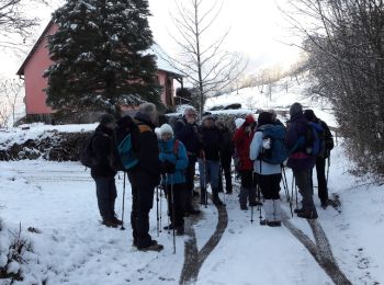
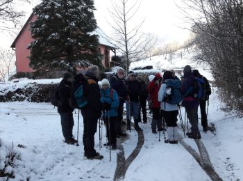
Trail Walking Moosch - Moosch Haag - Photo
Walking 20.918
Km

Walking

Difficult
(1)
Moosch, Grand Est, Haut-Rhin, France
21 km | 0 m-effort
5h 27min
0 m
0 m
Yes
Estelle Handschin

Trail Walking Moosch - Moos abri Faucon Crécerelle - Photo
Walking 14.395
Km

Walking

Very difficult
Moosch, Grand Est, Haut-Rhin, France
14.4 km | 24 km-effort
6h 32min
699 m
701 m
Yes
ROPPJP

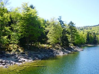
Trail Walking Moosch - Moosch - Gsang (19/08/2021) - Photo
Walking 12.349
Km

Walking

Medium
Moosch, Grand Est, Haut-Rhin, France
12.3 km | 20 km-effort
3h 50min
598 m
596 m
Yes
Richard68500

Trail Walking Moosch - De Moosch à Metzeral par Steinlebach en 2 étapes - Photo
Walking 34.358
Km

Walking

Difficult
Moosch, Grand Est, Haut-Rhin, France
34 km | 52 km-effort
10h 0min
1340 m
1257 m
No
tracegps

Trail On foot Moosch - Moosch Faucon Crerelle - Photo
On foot 13.073
Km

On foot

Difficult
Moosch, Grand Est, Haut-Rhin, France
13.1 km | 22 km-effort
Unknown
659 m
659 m
Yes
domi68440

Trail On foot Moosch - Moosch Faucon Crerelle - Photo
On foot 13.073
Km

On foot

Difficult
Moosch, Grand Est, Haut-Rhin, France
13.1 km | 22 km-effort
Unknown
659 m
659 m
Yes
domi68440

Trail Walking Moosch - 19.01.29.Mosch.Geishouse - Photo
Walking 9.417
Km

Walking

Very easy
Moosch, Grand Est, Haut-Rhin, France
9.4 km | 14.1 km-effort
3h 55min
353 m
353 m
Yes
ROPPJP

Trail Walking Moosch - 19.01.29.Mosch.Geishouse - Photo
Walking 9.417
Km

Walking

Very easy
Moosch, Grand Est, Haut-Rhin, France
9.4 km | 14.1 km-effort
3h 55min
353 m
353 m
Yes
ROPPJP

Trail Walking Moosch - Moosch - Le Markstein - Tour des Lacs des Vosges - Etape 1 - Photo
Walking 19.879
Km

Walking

Difficult
Moosch, Grand Est, Haut-Rhin, France
19.9 km | 34 km-effort
6h 0min
1289 m
467 m
No
tracegps

Trail Walking Moosch - SityTrail - Moosch-Rossberg - Photo
Walking 11.906
Km

Walking

Very difficult
Moosch, Grand Est, Haut-Rhin, France
11.9 km | 20 km-effort
4h 36min
626 m
626 m
Yes
JCLUTT

Trail Walking Moosch - moosch F.A Belaker - Photo
Walking 13.015
Km

Walking

Very difficult
Moosch, Grand Est, Haut-Rhin, France
13 km | 21 km-effort
4h 56min
573 m
578 m
Yes
lacote

Trail Walking Moosch - Mosch-14/02/23 Clas - Photo
Walking 19.72
Km

Walking

Moosch, Grand Est, Haut-Rhin, France
19.7 km | 32 km-effort
5h 55min
952 m
952 m
Yes
chantalwaltzer

Trail Walking Moosch - Moisch- Faucon crecerelle- Mehrbachel- 29/01/23 - Photo
Walking 19.179
Km

Walking

Easy
Moosch, Grand Est, Haut-Rhin, France
19.2 km | 31 km-effort
5h 40min
923 m
924 m
Yes
chantalwaltzer

Trail Walking Moosch - Moosch- Haag- Faucon crecerelle - Photo
Walking 21.989
Km

Walking

Medium
Moosch, Grand Est, Haut-Rhin, France
22 km | 36 km-effort
6h 8min
1073 m
1072 m
Yes
chantalwaltzer

Trail Walking Moosch - Mollau- copains 13/11- waldmatt- Thierru - Photo
Walking 17.464
Km

Walking

Moosch, Grand Est, Haut-Rhin, France
17.5 km | 25 km-effort
4h 36min
451 m
1005 m
No
chantalwaltzer

Trail Walking Moosch - Col du Hag - Photo
Walking 17.893
Km

Walking

Very difficult
Moosch, Grand Est, Haut-Rhin, France
17.9 km | 30 km-effort
6h 50min
914 m
915 m
Yes
MIFE68

Trail On foot Moosch - étape 1 Vallée de Thann jusqu'a vallée de Munster - Photo
On foot 14.806
Km

On foot

Medium
Moosch, Grand Est, Haut-Rhin, France
14.8 km | 26 km-effort
6h 40min
1012 m
204 m
No
senn francis

Trail Walking Moosch - CovidS02P01 - Photo
Walking 7.099
Km

Walking

Medium
Moosch, Grand Est, Haut-Rhin, France
7.1 km | 10.3 km-effort
1h 30min
239 m
239 m
Yes
MIFE68

Trail Walking Moosch - Moosch-Abri du Kolabi - Photo
Walking 7.092
Km

Walking

Difficult
Moosch, Grand Est, Haut-Rhin, France
7.1 km | 12.3 km-effort
4h 6min
392 m
394 m
Yes
JCLUTT

Trail Walking Moosch - Moosch-Blaufels - Photo
Walking 9.456
Km

Walking

Difficult
Moosch, Grand Est, Haut-Rhin, France
9.5 km | 17.2 km-effort
3h 27min
579 m
573 m
Yes
JCLUTT

20 trails displayed on 63

FREE GPS app for hiking

Logo SityTrail SityTrail

IGN / Geographical institutes

Download SityTrail from the App Store Download SityTrail from Google Play

Logo SityTrail SityTrail World

The world is yours!

Download SityTrail from the App Store Download SityTrail from Google Play Download SityTrail on Huawei AppGallery

Activities

Close
My subscriptions