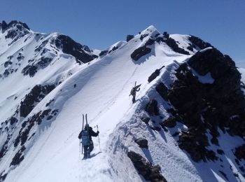
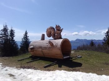
Theys, Isère, Winter sports: Best trails, routes and walks

5 comments

Theys: Discover the best trails: 5 touring skiing and 15 snowshoes. All these trails, routes and outdoor activities are available in our SityTrail applications for smartphones and tablets.


The best trails (20)
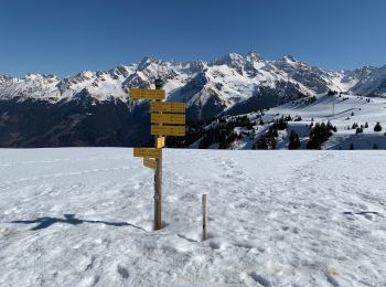
Trail Snowshoes Theys - Pipay Col du Merdatet - Photo
Snowshoes 8.971
Km

Snowshoes

Easy
Theys, Auvergne-Rhône-Alpes, Isère, France
9 km | 15.2 km-effort
4h 30min
467 m
468 m
Yes
Jeankrunk

Trail Snowshoes Theys - rocher rong  - Photo
Snowshoes 9.929
Km

Snowshoes

Very easy
(2)
Theys, Auvergne-Rhône-Alpes, Isère, France
9.9 km | 19.9 km-effort
4h 39min
748 m
754 m
Yes
druilhe

Trail Touring skiing Theys - Pipay, arête pour monter à la cime de la Jasse - Photo
Touring skiing 13.279
Km

Touring skiing

Medium
Theys, Auvergne-Rhône-Alpes, Isère, France
13.3 km | 33 km-effort
7h 35min
1472 m
1488 m
Yes
nadd73

Trail Touring skiing Theys - Pipay col des oudis et ++ - Photo
Touring skiing 13.441
Km

Touring skiing

Easy
Theys, Auvergne-Rhône-Alpes, Isère, France
13.4 km | 31 km-effort
6h 40min
1343 m
1343 m
Yes
nadd73

Trail Touring skiing Theys - 7 Laux - Photo
Touring skiing 10.513
Km

Touring skiing

Very easy
Theys, Auvergne-Rhône-Alpes, Isère, France
10.5 km | 26 km-effort
2h 24min
1128 m
1132 m
Yes
loicthev

Trail Snowshoes Theys - pipay col de merdaret - Photo
Snowshoes 9.326
Km

Snowshoes

Medium
Theys, Auvergne-Rhône-Alpes, Isère, France
9.3 km | 15.8 km-effort
2h 55min
483 m
484 m
Yes
bymarc26

Trail Snowshoes Theys - pipay boeuf - Photo
Snowshoes 9.176
Km

Snowshoes

Very easy
Theys, Auvergne-Rhône-Alpes, Isère, France
9.2 km | 15.3 km-effort
3h 1min
454 m
471 m
No
lionelnottat

Trail Snowshoes Theys - Col megaret - Photo
Snowshoes 10.925
Km

Snowshoes

Theys, Auvergne-Rhône-Alpes, Isère, France
10.9 km | 17.5 km-effort
5h 56min
493 m
501 m
Yes
GerardBal

Trail Snowshoes Theys - Sept-Laux - Pipay - Photo
Snowshoes 4.158
Km

Snowshoes

Medium
Theys, Auvergne-Rhône-Alpes, Isère, France
4.2 km | 7.4 km-effort
3h 9min
195 m
382 m
No
chuck

Trail Touring skiing Theys - 7Laux - Photo
Touring skiing 11.168
Km

Touring skiing

Very easy
Theys, Auvergne-Rhône-Alpes, Isère, France
11.2 km | 29 km-effort
5h 42min
1308 m
1312 m
Yes
fabrice FERRAZZI

Trail Snowshoes Theys - Pipay raquettes reel - Photo
Snowshoes 12.186
Km

Snowshoes

Difficult
Theys, Auvergne-Rhône-Alpes, Isère, France
12.2 km | 18.7 km-effort
3h 25min
485 m
497 m
No
lionelnottat

Trail Snowshoes Theys - G2 B G3 - Pipay-Col du Merdaret- Pipay - Photo
Snowshoes 8.345
Km

Snowshoes

Medium
Theys, Auvergne-Rhône-Alpes, Isère, France
8.3 km | 14.2 km-effort
Unknown
438 m
445 m
Yes
lionelnottat

Trail Snowshoes Theys - Pipay - col du Merdaret - Pipay - Photo
Snowshoes 11.96
Km

Snowshoes

Difficult
Theys, Auvergne-Rhône-Alpes, Isère, France
12 km | 19 km-effort
Unknown
527 m
532 m
Yes
lionelnottat

Trail Snowshoes Theys - Pipay Gd Rocher via croix de Monteynard - Photo
Snowshoes 14.405
Km

Snowshoes

Difficult
Theys, Auvergne-Rhône-Alpes, Isère, France
14.4 km | 22 km-effort
Unknown
543 m
550 m
Yes
rolland-a

Trail Snowshoes Theys - Pipay cul du pet - Photo
Snowshoes 10.22
Km

Snowshoes

Theys, Auvergne-Rhône-Alpes, Isère, France
10.2 km | 17 km-effort
5h 33min
506 m
511 m
Yes
nano54

Trail Snowshoes Theys - Pipay enfants - Photo
Snowshoes 5.672
Km

Snowshoes

Very easy
Theys, Auvergne-Rhône-Alpes, Isère, France
5.7 km | 10.4 km-effort
3h 28min
355 m
366 m
Yes
lionelnottat

Trail Snowshoes Theys - merdaret - Photo
Snowshoes 8.816
Km

Snowshoes

Very easy
Theys, Auvergne-Rhône-Alpes, Isère, France
8.8 km | 15.4 km-effort
5h 8min
493 m
498 m
Yes
lionelnottat

Trail Snowshoes Theys - le poulet - Photo
Snowshoes 8.682
Km

Snowshoes

Very easy
Theys, Auvergne-Rhône-Alpes, Isère, France
8.7 km | 13.7 km-effort
4h 3min
375 m
369 m
Yes
michelpacaut

Trail Snowshoes Theys - pipay gv - Photo
Snowshoes 12.654
Km

Snowshoes

Very easy
Theys, Auvergne-Rhône-Alpes, Isère, France
12.7 km | 19.1 km-effort
5h 59min
484 m
491 m
Yes
lionelnottat

Trail Touring skiing Theys - Sept Laux - Photo
Touring skiing 6.72
Km

Touring skiing

Easy
Theys, Auvergne-Rhône-Alpes, Isère, France
6.7 km | 15.4 km-effort
2h 46min
654 m
656 m
Yes
loicthev

20 trails displayed on 20

FREE GPS app for hiking

Logo SityTrail SityTrail

IGN / Geographical institutes

Download SityTrail from the App Store Download SityTrail from Google Play

Logo SityTrail SityTrail World

The world is yours!

Download SityTrail from the App Store Download SityTrail from Google Play Download SityTrail on Huawei AppGallery

Activities

Close
My subscriptions