Bouillon, Luxembourg: Best trails, routes and walks

199 comments

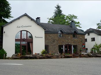
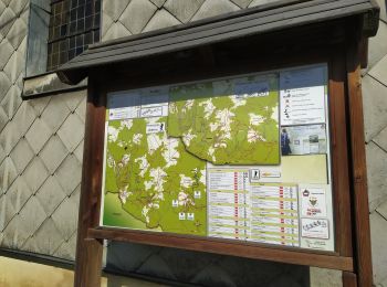
Bouillon: Discover the best trails: 745 hiking trails, 83 bike and mountain-bike routes and 35 equestrian circuits. All these trails, routes and outdoor activities are available in our SityTrail applications for smartphones and tablets.


The best trails (894)

Trail Walking Bouillon - RB-LUX-13 - Les belvédères bouillonnais - Photo
Walking 20.117
Km
PRO

Walking

Medium
(7)
Bouillon, Wallonia, Luxembourg, Belgium
20 km | 30 km-effort
5h 55min
719 m
720 m
Yes
GR Rando

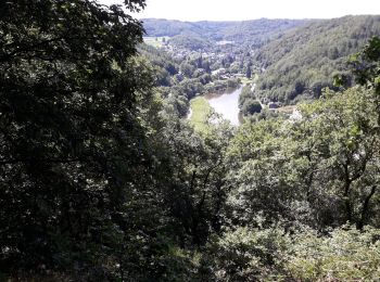
• Bouillon, la Ramonette, le rocher du Pendu, Corbion, la Chaire à Prêcher, Poupehan, le Gros Hêtre, Le Pic du Diable, ...

Trail Walking Bouillon - RB-Lu-12 - Premier contact avec la Semois au Tombeau du Géant - Photo
Walking 19.05
Km
PRO

Walking

Very difficult
(6)
Bouillon, Wallonia, Luxembourg, Belgium
19.1 km | 27 km-effort
6h 7min
592 m
592 m
Yes
GR Rando

• Vivy, Ucimont, Botassart, Sensenruth, Mogimont, Vivy Cartographie et documentation Cartes IGN au 1 : 20 000, 64/5-6 ...

Trail Walking Bouillon - RB-LUX-13 - Raccourci - Les belvédères bouillonnais - Photo
Walking 16.739
Km
PRO

Walking

Medium
(4)
Bouillon, Wallonia, Luxembourg, Belgium
16.7 km | 25 km-effort
4h 54min
584 m
585 m
Yes
GR Rando

• Bouillon, la Ramonette, le rocher du Pendu, Corbion, le Gros Hêtre, Le Pic du Diable, le point de vue de l’Épine, Bou...

Trail Walking Bouillon - De Corbion à la Roche aux Eperviers - Photo
Walking 10.628
Km
GUIDE

Walking

Easy
(1)
Bouillon, Wallonia, Luxembourg, Belgium
10.6 km | 14.6 km-effort
2h 50min
299 m
302 m
Yes
Desrumaux

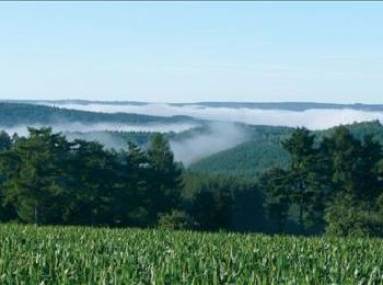
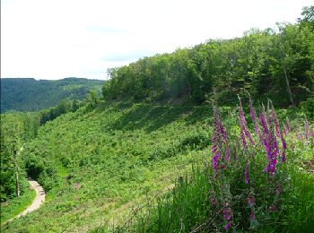
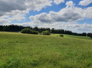
• Cette balade vous emmène sur la colline boisée que dominent les points de vue de la Roche aux Eperviers, de Germowé e...

Trail Walking Bouillon - De Poupehan à Frahan par le sentier des crêtes - Photo
Walking 8.77
Km
GUIDE

Walking

Medium
(2)
Bouillon, Wallonia, Luxembourg, Belgium
8.8 km | 12.5 km-effort
3h 0min
280 m
282 m
Yes
Desrumaux

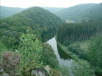
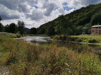
• Poupehan situé sur le versant méridional des Ardennes Belges, est un petit village bien exposé, blotti au bord de l'u...

Trail Walking Bouillon - De Corbion à Poupehan par la Roche des Fées et la Chaire à Prêcher - Photo
Walking 7.324
Km
GUIDE

Walking

Medium
(2)
Bouillon, Wallonia, Luxembourg, Belgium
7.3 km | 11.1 km-effort
3h 0min
288 m
279 m
Yes
Desrumaux

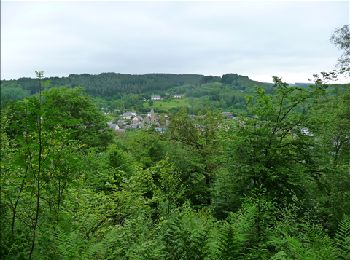
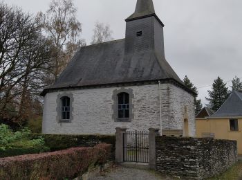
• Le village de Corbion est assis sur le plateau entre la Semois et la frontière française. A perte de vue, le paysage ...

Trail Walking Bouillon - Corbion - Le Sentier des Points de Vue - Photo
Walking 8.62
Km
GUIDE

Walking

Medium
(7)
Bouillon, Wallonia, Luxembourg, Belgium
8.6 km | 12.2 km-effort
3h 0min
270 m
271 m
Yes
Desrumaux

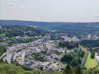
• Corbion est situé à 7 km de Bouillon dans les Ardennes Belges. Son altitude d'environ 410 m vous permet de découvrir ...

Trail Walking Bouillon - Promenade vers la Passerelle de l’épine  - Photo
Walking 7.344
Km
GUIDE+

Walking

Medium
(6)
Bouillon, Wallonia, Luxembourg, Belgium
7.3 km | 11.2 km-effort
2h 33min
292 m
292 m
Yes
Au fil de nos découvertes

Trail Walking Bouillon - Poupehan_Rochehaut_Frahan_Poupzhan - Photo
Walking 12.795
Km

Walking

Medium
(4)
Bouillon, Wallonia, Luxembourg, Belgium
12.8 km | 18.7 km-effort
5h 7min
447 m
439 m
Yes
Dom62

Trail Walking Bouillon - rochehaut 180620 - Photo
Walking 19.953
Km

Walking

Difficult
(1)
Bouillon, Wallonia, Luxembourg, Belgium
20 km | 31 km-effort
5h 1min
853 m
853 m
Yes
guyernage25

Trail Walking Bouillon - Noordelijke bossen Bouillon 15 km - Photo
Walking 16.211
Km

Walking

Very difficult
(1)
Bouillon, Wallonia, Luxembourg, Belgium
16.2 km | 24 km-effort
3h 43min
596 m
596 m
Yes
mavbelgium

Trail Walking Bouillon - De Bouillon vers Corbion par le Tombeau du Geant - Photo
Walking 20.196
Km
GUIDE

Walking

Difficult
(5)
Bouillon, Wallonia, Luxembourg, Belgium
20 km | 30 km-effort
5h 0min
747 m
747 m
Yes
Desrumaux

• Details sur TraceGPS.com http://www.tracegps.com/fr/parcours/circuit6628.htm

Trail Walking Bouillon - Le Sentier des Points de Vues - Bouillon - Photo
Walking 8.454
Km
GUIDE

Walking

Difficult
Bouillon, Wallonia, Luxembourg, Belgium
8.5 km | 12.2 km-effort
2h 47min
284 m
286 m
Yes
Desrumaux

Trail Walking Bouillon - Promenade du Moulin du Rivage. (3,5km) - Photo
Walking 3.346
Km
GUIDE+

Walking

Easy
(2)
Bouillon, Wallonia, Luxembourg, Belgium
3.3 km | 5.3 km-effort
1h 12min
149 m
145 m
Yes
Au fil de nos découvertes

Trail On foot Bouillon - Promenade de la Roche percée 47 - Photo
On foot 6.307
Km
GUIDE+

On foot

Easy
(1)
Bouillon, Wallonia, Luxembourg, Belgium
6.3 km | 8.7 km-effort
1h 58min
179 m
173 m
Yes
Commissariat général au Tourisme

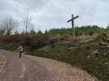
• Trail created by Pays de Bouillon en Ardenne. Starting in Les Hayons, the walk descends via the street to the vie...

Trail On foot Bouillon - Promenade de la Ramonette et arboretum 8 - Photo
On foot 3.943
Km
PRO

On foot

Easy
(1)
Bouillon, Wallonia, Luxembourg, Belgium
3.9 km | 6.1 km-effort
1h 23min
163 m
159 m
Yes
SityTrail - itinéraires balisés pédestres

• Trail created by Maison du Tourisme du Pays de Bouillon.

Trail On foot Bouillon - Promenade de Viaumont - Rivage de Marion 40 - Photo
On foot 5.502
Km
GUIDE+

On foot

Easy
(1)
Bouillon, Wallonia, Luxembourg, Belgium
5.5 km | 7.7 km-effort
1h 44min
162 m
163 m
Yes
Commissariat général au Tourisme

• Trail created by Pays de Bouillon en Ardenne.

Trail On foot Bouillon - Promenade gros chêne français et chêne des Mouches 21 - Photo
On foot 9.711
Km
GUIDE+

On foot

Easy
Bouillon, Wallonia, Luxembourg, Belgium
9.7 km | 13.3 km-effort
3h 1min
271 m
267 m
Yes
Commissariat général au Tourisme

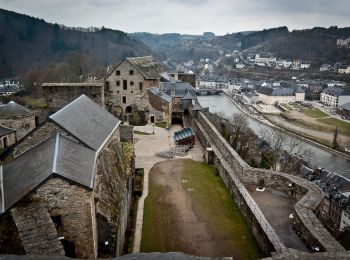
• Trail created by Pays de Bouillon en Ardenne. Nice and easy walk to the Charlier viewpoint and among other things...

Trail On foot Bouillon - Promenade Chaire à prêcher-Croisettes-Moulin Joly - Photo
On foot 5.415
Km
GUIDE+

On foot

Easy
Bouillon, Wallonia, Luxembourg, Belgium
5.4 km | 7.5 km-effort
1h 42min
157 m
156 m
Yes
Commissariat général au Tourisme

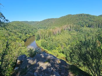
• Trail created by Pays de Bouillon en Ardenne. Venture along the ridge path to discover the magnificent view of th...

Trail On foot Bouillon - Promenade du Moulin du Rivage 92 - Photo
On foot 3.256
Km
GUIDE+

On foot

Easy
Bouillon, Wallonia, Luxembourg, Belgium
3.3 km | 5.2 km-effort
1h 10min
148 m
138 m
Yes
Commissariat général au Tourisme

• Trail created by Pays de Bouillon en Ardenne.

20 trails displayed on 894

FREE GPS app for hiking

Logo SityTrail SityTrail

IGN / Geographical institutes

Download SityTrail from the App Store Download SityTrail from Google Play

Logo SityTrail SityTrail World

The world is yours!

Download SityTrail from the App Store Download SityTrail from Google Play Download SityTrail on Huawei AppGallery

Activities

Nearby regions

Close
My subscriptions