Area B (Shelter Bay/Mica Creek), Columbia-Shuswap Regional District: Best trails, routes and walks

1 comments

Area B (Shelter Bay/Mica Creek): Discover the best trails: 3 hiking trails. All these trails, routes and outdoor activities are available in our SityTrail applications for smartphones and tablets.


The best trails (3)

Trail Walking Area B (Shelter Bay/Mica Creek) - Meadows Of the Sky Trailo - Photo
Walking 7.047
Km

Walking

Medium
(1)
Area B (Shelter Bay/Mica Creek), British Columbia, Columbia-Shuswap Regional District, Canada
7 km | 9.9 km-effort
1h 50min
213 m
224 m
No
huguesdelaval

Trail Walking Area B (Shelter Bay/Mica Creek) - Crete Abbott  parc des glaciers - Photo
Walking 13.88
Km

Walking

Difficult
Area B (Shelter Bay/Mica Creek), British Columbia, Columbia-Shuswap Regional District, Canada
13.9 km | 28 km-effort
5h 43min
1044 m
1054 m
No
marcagif

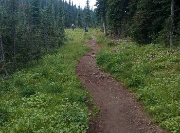
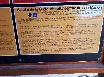
• start from the campground to the ridge . trail #18

Trail Trail Area B (Shelter Bay/Mica Creek) - glacier nal park Abbot - Photo
Trail 13.36
Km

Trail

Medium
Area B (Shelter Bay/Mica Creek), British Columbia, Columbia-Shuswap Regional District, Canada
13.4 km | 25 km-effort
6h 13min
844 m
1064 m
No
Bertrand Simon

3 trails displayed on 3

FREE GPS app for hiking

Logo SityTrail SityTrail

IGN / Geographical institutes

Download SityTrail from the App Store Download SityTrail from Google Play

Logo SityTrail SityTrail World

The world is yours!

Download SityTrail from the App Store Download SityTrail from Google Play Download SityTrail on Huawei AppGallery

Activities

Close
My subscriptions