Hallerndorf, Landkreis Forchheim: Best trails, routes and walks

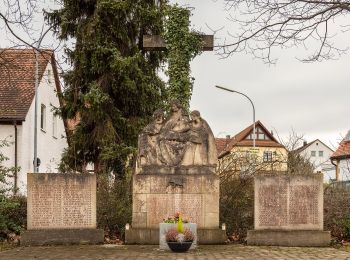
Hallerndorf: Discover the best trails: 9 hiking trails. All these trails, routes and outdoor activities are available in our SityTrail applications for smartphones and tablets.


The best trails (9)

Trail On foot Hallerndorf - Lauferlebnis Fränkische Schweiz - Photo
On foot 3.523
Km
PRO

On foot

Easy
Hallerndorf, Bavaria, Landkreis Forchheim, Germany
3.5 km | 4.1 km-effort
56min
46 m
46 m
Yes
SityTrail - itinéraires balisés pédestres

• Trail created by Landratsamt Forchheim. Symbol: F4 in weiß auf grünem Hintergrund

Trail On foot Hallerndorf - Lauferlebnis Fränkische Schweiz - Photo
On foot 6.765
Km
PRO

On foot

Easy
Hallerndorf, Bavaria, Landkreis Forchheim, Germany
6.8 km | 8 km-effort
1h 48min
92 m
92 m
Yes
SityTrail - itinéraires balisés pédestres

• Trail created by Landratsamt Forchheim. Symbol: F5 in weiß auf schwarzem Hintergrund

Trail On foot Hallerndorf - Rundweg Hallerndorf Grüner Ring - Photo
On foot 15.885
Km
PRO

On foot

Easy
Hallerndorf, Bavaria, Landkreis Forchheim, Germany
15.9 km | 18.8 km-effort
4h 15min
216 m
216 m
Yes
SityTrail - itinéraires balisés pédestres

• Trail created by Gemeinde Hallerndorf. Symbol: Grüner Ring auf weißem Grund

Trail On foot Hallerndorf - Rundweg Hallerndorf - Photo
On foot 13.288
Km
PRO

On foot

Easy
Hallerndorf, Bavaria, Landkreis Forchheim, Germany
13.3 km | 15.8 km-effort
3h 35min
190 m
189 m
Yes
SityTrail - itinéraires balisés pédestres

• Symbol: gelber Ring auf weißem Grund

Trail On foot Hallerndorf - Neuses-Ebermannstadt - Photo
On foot 25.921
Km
PRO

On foot

Difficult
Hallerndorf, Bavaria, Landkreis Forchheim, Germany
26 km | 34 km-effort
7h 42min
611 m
569 m
No
SityTrail - itinéraires balisés pédestres

• Trail created by Naturpark Fränkische Schweiz-Veldensteiner Forst. Symbol: Gelber senkrechter Strich auf weissem Hin...

Trail On foot Hallerndorf - Forchheim-Kreuzberg 1 - Photo
On foot 9.337
Km
PRO

On foot

Easy
Hallerndorf, Bavaria, Landkreis Forchheim, Germany
9.3 km | 11.7 km-effort
2h 39min
165 m
223 m
No
SityTrail - itinéraires balisés pédestres

• Trail created by Stadt Forchheim. Symbol: gelbe Raute

Trail On foot Hallerndorf - Forchheim-Kreuzberg 2 - Photo
On foot 9.54
Km
PRO

On foot

Easy
Hallerndorf, Bavaria, Landkreis Forchheim, Germany
9.5 km | 11.8 km-effort
2h 40min
153 m
210 m
No
SityTrail - itinéraires balisés pédestres

• Trail created by Stadt Forchheim. Symbol: gelber Senkrechtstrich

Trail On foot Hallerndorf - Lauferlebnis Fränkische Schweiz F6 - Photo
On foot 5.915
Km
PRO

On foot

Easy
Hallerndorf, Bavaria, Landkreis Forchheim, Germany
5.9 km | 7.3 km-effort
1h 39min
101 m
101 m
Yes
SityTrail - itinéraires balisés pédestres

• Trail created by Landratsamt Forchheim. Symbol: F6 in weiß auf dunkelrotem Hintergrund

Trail On foot Hallerndorf - Lauferlebnis Fränkische Schweiz F7 - Photo
On foot 7.474
Km
PRO

On foot

Easy
Hallerndorf, Bavaria, Landkreis Forchheim, Germany
7.5 km | 9.1 km-effort
2h 3min
119 m
119 m
Yes
SityTrail - itinéraires balisés pédestres

• Trail created by Landratsamt Forchheim. Symbol: F7 in weiß auf blauem Grund

9 trails displayed on 9

FREE GPS app for hiking

Logo SityTrail SityTrail

IGN / Geographical institutes

Download SityTrail from the App Store Download SityTrail from Google Play

Logo SityTrail SityTrail World

The world is yours!

Download SityTrail from the App Store Download SityTrail from Google Play Download SityTrail on Huawei AppGallery

Activities

Close
My subscriptions