Sainte-Colombe-sur-Gand, Loire: Best trails, routes and walks

4 comments

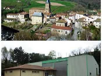
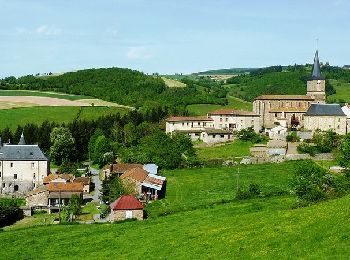
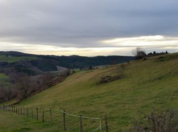
Sainte-Colombe-sur-Gand: Discover the best trails: 6 hiking trails and 2 bike and mountain-bike routes. All these trails, routes and outdoor activities are available in our SityTrail applications for smartphones and tablets.


The best trails (9)

Trail Mountain bike Sainte-Colombe-sur-Gand - Le viaduc du Pont Marteau - Sainte Colombe sur Gand - Photo
Mountain bike 25.164
Km

Mountain bike

Difficult
Sainte-Colombe-sur-Gand, Auvergne-Rhône-Alpes, Loire, France
25 km | 35 km-effort
2h 15min
738 m
737 m
Yes
tracegps

Trail Walking Sainte-Colombe-sur-Gand - Le viaduc du Pont Marteau - Sainte Colombe sur Gand - Photo
Walking 25.164
Km

Walking

Very difficult
Sainte-Colombe-sur-Gand, Auvergne-Rhône-Alpes, Loire, France
25 km | 35 km-effort
6h 0min
738 m
737 m
Yes
tracegps

Trail Walking Sainte-Colombe-sur-Gand - Le Pont Marteau et la vallée du Bernand - Sainte Colombe sur Gand - Photo
Walking 10.903
Km

Walking

Medium
(3)
Sainte-Colombe-sur-Gand, Auvergne-Rhône-Alpes, Loire, France
10.9 km | 15 km-effort
3h 0min
309 m
309 m
Yes
tracegps

Trail Walking Sainte-Colombe-sur-Gand - viaduc du marteau - Photo
Walking 10.004
Km

Walking

Easy
(1)
Sainte-Colombe-sur-Gand, Auvergne-Rhône-Alpes, Loire, France
10 km | 14.2 km-effort
2h 12min
313 m
314 m
Yes
dudu42

Trail sport Sainte-Colombe-sur-Gand - 2021-04-26_10h12m22_SityTrail - 2341860 - terres-des-tisseurs--sainte-colombexnerondet - Photo
sport 7.909
Km

sport

Very easy
Sainte-Colombe-sur-Gand, Auvergne-Rhône-Alpes, Loire, France
7.9 km | 10.8 km-effort
Unknown
200 m
266 m
No
Georgesferrier

• circuit avec traçé reel reperé sur le terrain avec JP et Irène

Trail Walking Sainte-Colombe-sur-Gand - sainte colombe sur gand - Photo
Walking 14.23
Km

Walking

Medium
Sainte-Colombe-sur-Gand, Auvergne-Rhône-Alpes, Loire, France
14.2 km | 21 km-effort
3h 59min
480 m
476 m
Yes
Sylvain Lassabliere

Trail Walking Sainte-Colombe-sur-Gand - pont marteau sainte colombe sur gand - Photo
Walking 14.275
Km

Walking

Very difficult
Sainte-Colombe-sur-Gand, Auvergne-Rhône-Alpes, Loire, France
14.3 km | 21 km-effort
4h 40min
475 m
468 m
Yes
poterie

Trail Walking Sainte-Colombe-sur-Gand - saint colombe sur gand pont marteau - Photo
Walking 8.677
Km

Walking

Medium
Sainte-Colombe-sur-Gand, Auvergne-Rhône-Alpes, Loire, France
8.7 km | 11.8 km-effort
2h 41min
236 m
234 m
Yes
poterie

Trail Road bike Sainte-Colombe-sur-Gand - ggggg - Photo
Road bike 5.695
Km

Road bike

Easy
Sainte-Colombe-sur-Gand, Auvergne-Rhône-Alpes, Loire, France
5.7 km | 7 km-effort
15min
104 m
94 m
No
rserrut

9 trails displayed on 9

FREE GPS app for hiking

Logo SityTrail SityTrail

IGN / Geographical institutes

Download SityTrail from the App Store Download SityTrail from Google Play

Logo SityTrail SityTrail World

The world is yours!

Download SityTrail from the App Store Download SityTrail from Google Play Download SityTrail on Huawei AppGallery

Activities

Close
My subscriptions