Le Biot, Upper Savoy: Best trails, routes and walks

Le Biot: Discover the best trails: 4 hiking trails. All these trails, routes and outdoor activities are available in our SityTrail applications for smartphones and tablets.


The best trails (5)

Trail Walking Le Biot - La Pointe de la Croix depuis le Biot - Photo
Walking 19.329
Km

Walking

Medium
Le Biot, Auvergne-Rhône-Alpes, Upper Savoy, France
19.3 km | 34 km-effort
7h 2min
1138 m
1137 m
Yes
thierry13710

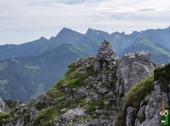
• Beau circuit au départ du Biot avec l'ascension de la pointe de la Croix. Traversée de nombreux hameaux. Belle vue au...

Trail Walking Le Biot - Le Mont Ouzon 1880 m, depuis le Col du Corbier - Photo
Walking 6.225
Km

Walking

Difficult
Le Biot, Auvergne-Rhône-Alpes, Upper Savoy, France
6.2 km | 14.4 km-effort
3h 30min
616 m
616 m
Yes
tracegps

Trail Walking Le Biot - Le Biot - Seytroux - Photo
Walking 9.35
Km

Walking

Very easy
Le Biot, Auvergne-Rhône-Alpes, Upper Savoy, France
9.3 km | 14.3 km-effort
3h 5min
373 m
371 m
Yes
thierry13710

• Circuit entre Le Biot, Urine, Seytroux

Trail Walking Le Biot - Le Biot - Abbaye de Saint Jean d'Aups - Photo
Walking 7.821
Km

Walking

Easy
Le Biot, Auvergne-Rhône-Alpes, Upper Savoy, France
7.8 km | 11.4 km-effort
2h 30min
266 m
265 m
Yes
thierry13710

• Petite promenade tranquille jusqu'à l'Abbaye de Saint Jean d'Aups en aller-retour

Trail Other activity Le Biot - POINTE DE LA CROIX - Photo
Other activity 12.434
Km

Other activity

Medium
Le Biot, Auvergne-Rhône-Alpes, Upper Savoy, France
12.4 km | 21 km-effort
4h 0min
679 m
680 m
Yes
lisph

5 trails displayed on 5

FREE GPS app for hiking

Logo SityTrail SityTrail

IGN / Geographical institutes

Download SityTrail from the App Store Download SityTrail from Google Play

Logo SityTrail SityTrail World

The world is yours!

Download SityTrail from the App Store Download SityTrail from Google Play Download SityTrail on Huawei AppGallery

Activities

Close
My subscriptions