Bert, Allier: Best trails, routes and walks

2 comments

Bert: Discover the best trails: 2 hiking trails and 1 bike and mountain-bike routes. All these trails, routes and outdoor activities are available in our SityTrail applications for smartphones and tablets.
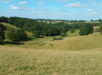

The best trails (3)

Trail Walking Bert - Boucle du Roc - BERT - Photo
Walking 12.529
Km

Walking

Medium
(1)
Bert, Auvergne-Rhône-Alpes, Allier, France
12.5 km | 16.6 km-effort
3h 36min
304 m
311 m
Yes
coco03

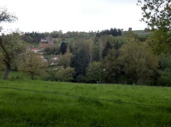
• Attention passage difficile dans les bois après l'étang des Gouttes (sentier non entretenu) le reste, ok.

Trail Walking Bert - Bert, la Tour Pouçain - Photo
Walking 11.45
Km

Walking

Medium
(1)
Bert, Auvergne-Rhône-Alpes, Allier, France
11.4 km | 14.7 km-effort
3h 19min
245 m
240 m
No
coco03

• Départ bourg de Bert : Plan d’eau du Camping Communautaire – durée 2h45 (Parcours mixte avec quelques montées) Le ran...

Trail Cycle Bert - Bert-Nuits st Georges - Photo
Cycle 163.111
Km

Cycle

Easy
Bert, Auvergne-Rhône-Alpes, Allier, France
163 km | 183 km-effort
Unknown
1483 m
1558 m
No
NOVICLIE

3 trails displayed on 3

FREE GPS app for hiking

Logo SityTrail SityTrail

IGN / Geographical institutes

Download SityTrail from the App Store Download SityTrail from Google Play

Logo SityTrail SityTrail World

The world is yours!

Download SityTrail from the App Store Download SityTrail from Google Play Download SityTrail on Huawei AppGallery

Activities

Close
My subscriptions