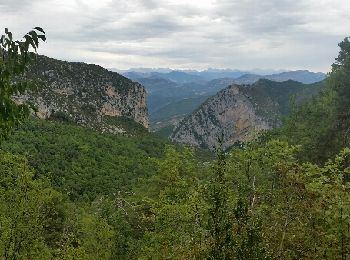
Le Mas, Maritime Alps: Best trails, routes and walks

Le Mas: Discover the best trails: 21 hiking trails. All these trails, routes and outdoor activities are available in our SityTrail applications for smartphones and tablets.


The best trails (21)

Trail On foot Le Mas - Grand tour du haut Estéron - Etape 3 - Photo
On foot 12.057
Km
PRO

On foot

Medium
Le Mas, Provence-Alpes-Côte d'Azur, Maritime Alps, France
12.1 km | 25 km-effort
5h 35min
1018 m
701 m
No
SityTrail - itinéraires balisés pédestres

• Randonnée pédestre - Au départ de Saint-Auban (1 100 m) Website: https://randoxygene.departement06.fr/traversees/gra...

Trail On foot Le Mas - Montagne de Charamel - Photo
On foot 12.22
Km
PRO

On foot

Medium
Le Mas, Provence-Alpes-Côte d'Azur, Maritime Alps, France
12.2 km | 24 km-effort
5h 29min
891 m
902 m
Yes
SityTrail - itinéraires balisés pédestres

• Randonnée pédestre - Au départ de Le Mas (930 m) Website: https://randoxygene.departement06.fr/esteron/montagne-de-c...

Trail Walking Le Mas - Le Masse - charamel - Photo
Walking 12.728
Km

Walking

Very easy
Le Mas, Provence-Alpes-Côte d'Azur, Maritime Alps, France
12.7 km | 25 km-effort
4h 18min
892 m
906 m
Yes
thierry13710

Trail Walking Le Mas - charamel - Photo
Walking 12.875
Km

Walking

Very difficult
Le Mas, Provence-Alpes-Côte d'Azur, Maritime Alps, France
12.9 km | 25 km-effort
4h 13min
906 m
910 m
Yes
MauriceJardret

Trail Other activity Le Mas - Le mas - Photo
Other activity 13.966
Km

Other activity

Very easy
Le Mas, Provence-Alpes-Côte d'Azur, Maritime Alps, France
14 km | 26 km-effort
6h 8min
908 m
915 m
Yes
kenleggat

Trail Walking Le Mas - Arpille - Photo
Walking 13.246
Km

Walking

Difficult
Le Mas, Provence-Alpes-Côte d'Azur, Maritime Alps, France
13.2 km | 24 km-effort
7h 18min
803 m
803 m
Yes
Benteux

Trail Walking Le Mas - Arpille - Photo
Walking 13.246
Km

Walking

Difficult
Le Mas, Provence-Alpes-Côte d'Azur, Maritime Alps, France
13.2 km | 24 km-effort
7h 18min
803 m
803 m
Yes
Benteux

Trail Walking Le Mas - charamel - Photo
Walking 13.026
Km

Walking

Very easy
Le Mas, Provence-Alpes-Côte d'Azur, Maritime Alps, France
13 km | 25 km-effort
6h 3min
901 m
902 m
Yes
herveschmitt

Trail On foot Le Mas - Le Mas - L'Arpille - Photo
On foot 12.889
Km

On foot

Medium
Le Mas, Provence-Alpes-Côte d'Azur, Maritime Alps, France
12.9 km | 24 km-effort
5h 20min
795 m
805 m
Yes
LURIENNE

Trail On foot Le Mas - Montagne de Bane - Le Mas - Photo
On foot 6.178
Km

On foot

Medium
Le Mas, Provence-Alpes-Côte d'Azur, Maritime Alps, France
6.2 km | 12.6 km-effort
2h 51min
478 m
487 m
Yes
LURIENNE

Trail Walking Le Mas - col de bleine greollieres - Photo
Walking 9.073
Km

Walking

Difficult
Le Mas, Provence-Alpes-Côte d'Azur, Maritime Alps, France
9.1 km | 15.4 km-effort
3h 30min
455 m
544 m
No
dianecoste

Trail Walking Le Mas - L'Arpille depuis le Mas - Photo
Walking 15.583
Km

Walking

Easy
Le Mas, Provence-Alpes-Côte d'Azur, Maritime Alps, France
15.6 km | 26 km-effort
4h 23min
811 m
820 m
Yes
Thierryrando06

Trail On foot Le Mas - L'Arpille depuis le Mas - Photo
On foot 14.654
Km

On foot

Medium
Le Mas, Provence-Alpes-Côte d'Azur, Maritime Alps, France
14.7 km | 25 km-effort
5h 44min
795 m
796 m
Yes
GDE

Trail On foot Le Mas - L'Arpille depuis le Mas - Photo
On foot 14.654
Km

On foot

Medium
Le Mas, Provence-Alpes-Côte d'Azur, Maritime Alps, France
14.7 km | 25 km-effort
5h 44min
795 m
796 m
Yes
GDE

Trail Walking Le Mas - Col de l'Aiglo - Photo
Walking 4.192
Km

Walking

Very easy
Le Mas, Provence-Alpes-Côte d'Azur, Maritime Alps, France
4.2 km | 6.3 km-effort
2h 3min
161 m
163 m
Yes
Tibal

Trail Walking Le Mas - Pic de Fourneuby - Photo
Walking 13.458
Km

Walking

Medium
Le Mas, Provence-Alpes-Côte d'Azur, Maritime Alps, France
13.5 km | 23 km-effort
4h 35min
746 m
751 m
Yes
lebegue06

Trail Walking Le Mas - GR4 (3) - Photo
Walking 13.596
Km

Walking

Very difficult
Le Mas, Provence-Alpes-Côte d'Azur, Maritime Alps, France
13.6 km | 27 km-effort
5h 37min
1116 m
716 m
No
chasle

Trail Walking Le Mas - Les Tardons à Le Mas - Photo
Walking 12.456
Km

Walking

Medium
Le Mas, Provence-Alpes-Côte d'Azur, Maritime Alps, France
12.5 km | 24 km-effort
5h 7min
885 m
868 m
Yes
Thierryrando06

Trail Walking Le Mas - Circuit le Mas 1/2 - Photo
Walking 8.564
Km

Walking

Medium
Le Mas, Provence-Alpes-Côte d'Azur, Maritime Alps, France
8.6 km | 15.9 km-effort
3h 30min
554 m
554 m
Yes
Michelisabelle

Trail Walking Le Mas - Circuit Le Mas - Photo
Walking 12.54
Km

Walking

Difficult
Le Mas, Provence-Alpes-Côte d'Azur, Maritime Alps, France
12.5 km | 24 km-effort
5h 8min
886 m
894 m
Yes
Michelisabelle

20 trails displayed on 21

FREE GPS app for hiking

Logo SityTrail SityTrail

IGN / Geographical institutes

Download SityTrail from the App Store Download SityTrail from Google Play

Logo SityTrail SityTrail World

The world is yours!

Download SityTrail from the App Store Download SityTrail from Google Play Download SityTrail on Huawei AppGallery

Activities

Close
My subscriptions