Lucéram, Maritime Alps: Best trails, routes and walks

2 comments

Lucéram: Discover the best trails: 39 hiking trails and 9 bike and mountain-bike routes. All these trails, routes and outdoor activities are available in our SityTrail applications for smartphones and tablets.


The best trails (51)

Trail On foot Lucéram - Circuit du Grand Braus - Photo
On foot 9.89
Km
PRO

On foot

Easy
Lucéram, Provence-Alpes-Côte d'Azur, Maritime Alps, France
9.9 km | 18.6 km-effort
4h 13min
652 m
647 m
Yes
SityTrail - itinéraires balisés pédestres

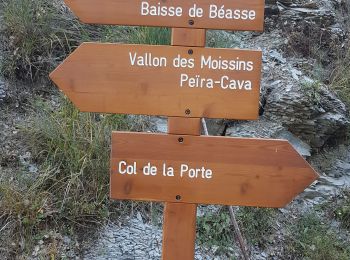
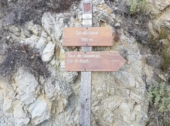
• Randonnée pédestre - Au départ de Lucéram (650 m) Website: https://randoxygene.departement06.fr/bevera-paillon/circu...

Trail Walking Lucéram - Beasse Peira Cava  - Photo
Walking 18.977
Km

Walking

Difficult
Lucéram, Provence-Alpes-Côte d'Azur, Maritime Alps, France
19 km | 31 km-effort
9h 50min
925 m
925 m
Yes
Renefrt

Trail Walking Lucéram - Col de Porte Col de L’Autaret - Photo
Walking 11.217
Km

Walking

Medium
Lucéram, Provence-Alpes-Côte d'Azur, Maritime Alps, France
11.2 km | 26 km-effort
5h 8min
1141 m
1141 m
Yes
Renefrt

Trail Walking Lucéram - Cime Roccasiera a/r - Photo
Walking 7.604
Km

Walking

Medium
Lucéram, Provence-Alpes-Côte d'Azur, Maritime Alps, France
7.6 km | 14.4 km-effort
3h 46min
512 m
515 m
Yes
patsure

Trail Walking Lucéram - Luceram - Col de l'Orme et retour - Photo
Walking 9.167
Km

Walking

Easy
Lucéram, Provence-Alpes-Côte d'Azur, Maritime Alps, France
9.2 km | 16.1 km-effort
5h 0min
520 m
523 m
Yes
LtZIP

Trail Walking Lucéram - Col St Roch Cime Daurieras - Photo
Walking 13.286
Km

Walking

Medium
(2)
Lucéram, Provence-Alpes-Côte d'Azur, Maritime Alps, France
13.3 km | 23 km-effort
5h 16min
740 m
736 m
Yes
xelot

Trail Walking Lucéram - L’Able - Photo
Walking 8.663
Km

Walking

Medium
Lucéram, Provence-Alpes-Côte d'Azur, Maritime Alps, France
8.7 km | 15.9 km-effort
6h 20min
540 m
541 m
Yes
Renefrt

Trail On foot Lucéram - Circuit de Béasse - Photo
On foot 16.829
Km
PRO

On foot

Medium
Lucéram, Provence-Alpes-Côte d'Azur, Maritime Alps, France
16.8 km | 28 km-effort
6h 16min
811 m
811 m
Yes
SityTrail - itinéraires balisés pédestres

• Randonnée pédestre - Au départ de Lucéram, Route Métropolitaine 73, lieu-dit La Gabella (910 m) Website: https://ran...

Trail Walking Lucéram - Luceram Caire et col de Brauss - Photo
Walking 10.035
Km

Walking

Medium
Lucéram, Provence-Alpes-Côte d'Azur, Maritime Alps, France
10 km | 18.8 km-effort
3h 18min
657 m
656 m
Yes
REYPatrick

Trail Walking Lucéram - luceram le grd braus  - Photo
Walking 10.678
Km

Walking

Medium
Lucéram, Provence-Alpes-Côte d'Azur, Maritime Alps, France
10.7 km | 19.6 km-effort
4h 59min
667 m
671 m
Yes
manouete

Trail Walking Lucéram - Mont Rocassiera - Photo
Walking 5.103
Km

Walking

Difficult
Lucéram, Provence-Alpes-Côte d'Azur, Maritime Alps, France
5.1 km | 13 km-effort
5h 41min
577 m
647 m
No
Renefrt

Trail Walking Lucéram - Luceram - Photo
Walking 10.632
Km

Walking

Medium
Lucéram, Provence-Alpes-Côte d'Azur, Maritime Alps, France
10.6 km | 21 km-effort
5h 57min
780 m
787 m
Yes
domi06

Trail On foot Lucéram - Col St roch - Photo
On foot 11.81
Km

On foot

Medium
Lucéram, Provence-Alpes-Côte d'Azur, Maritime Alps, France
11.8 km | 19.2 km-effort
4h 22min
558 m
558 m
Yes
Renefrt

Trail Walking Lucéram - Braus col - Photo
Walking 11.255
Km

Walking

Easy
Lucéram, Provence-Alpes-Côte d'Azur, Maritime Alps, France
11.3 km | 16.9 km-effort
2h 57min
421 m
417 m
Yes
Cornelius-Fronton

Trail Walking Lucéram - LUCERAM -COL DE L'ABLE  - Photo
Walking 9.978
Km

Walking

Medium
Lucéram, Provence-Alpes-Côte d'Azur, Maritime Alps, France
10 km | 18.6 km-effort
4h 13min
650 m
643 m
Yes
Benteux

Trail Walking Lucéram - 2020-08-18_13h05m46_Beasse Peira-Cava - Photo
Walking 15.343
Km

Walking

Difficult
Lucéram, Provence-Alpes-Côte d'Azur, Maritime Alps, France
15.3 km | 26 km-effort
5h 20min
813 m
814 m
Yes
Renefrt

Trail Walking Lucéram - 3619227-track-1594366842-595 - Photo
Walking 10.582
Km

Walking

Medium
Lucéram, Provence-Alpes-Côte d'Azur, Maritime Alps, France
10.6 km | 16.3 km-effort
3h 22min
429 m
417 m
Yes
Renefrt

Trail Walking Lucéram - Cime de Roccasiera depuis col de la Porte - Photo
Walking 11.397
Km

Walking

Difficult
Lucéram, Provence-Alpes-Côte d'Azur, Maritime Alps, France
11.4 km | 18.9 km-effort
3h 52min
563 m
561 m
Yes
patsure

Trail On foot Lucéram - 2020-01-26_18h05m39_9467061-track-1557337951-415 - Photo
On foot 16.771
Km

On foot

Difficult
Lucéram, Provence-Alpes-Côte d'Azur, Maritime Alps, France
16.8 km | 33 km-effort
Unknown
1211 m
1212 m
Yes
Renefrt

Trail Walking Lucéram - Circuit du grand Braus de Luceram - Photo
Walking 10.857
Km

Walking

Medium
Lucéram, Provence-Alpes-Côte d'Azur, Maritime Alps, France
10.9 km | 21 km-effort
7h 4min
787 m
788 m
Yes
GrouGary

• Montée versant Sud du Mt Auri puis crête du grd Braus (tres belle vue mais ronces) et Col de l'Able

20 trails displayed on 51

FREE GPS app for hiking

Logo SityTrail SityTrail

IGN / Geographical institutes

Download SityTrail from the App Store Download SityTrail from Google Play

Logo SityTrail SityTrail World

The world is yours!

Download SityTrail from the App Store Download SityTrail from Google Play Download SityTrail on Huawei AppGallery

Activities

Close
My subscriptions