Saint-Christol-lez-Alès, Gard: Best trails, routes and walks

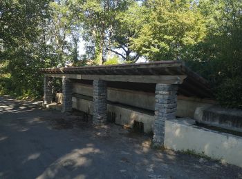
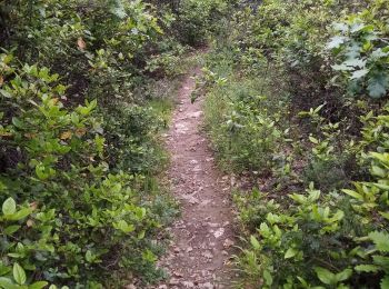
Saint-Christol-lez-Alès: Discover the best trails: 10 hiking trails and 3 bike and mountain-bike routes. All these trails, routes and outdoor activities are available in our SityTrail applications for smartphones and tablets.


The best trails (13)

Trail Walking Saint-Christol-lez-Alès - Randonnée Domaine du Rouret 20 mai 2020  - Photo
Walking 7.29
Km

Walking

Very easy
Saint-Christol-lez-Alès, Occitania, Gard, France
7.3 km | 8.3 km-effort
1h 49min
73 m
73 m
Yes
Khoe Khoe

Trail Walking Saint-Christol-lez-Alès - Valz - Photo
Walking 8.172
Km

Walking

Medium
Saint-Christol-lez-Alès, Occitania, Gard, France
8.2 km | 11 km-effort
2h 10min
216 m
214 m
Yes
access

Trail Walking Saint-Christol-lez-Alès - St Christol les Ales(Le Rouret) - Photo
Walking 8.249
Km

Walking

Easy
Saint-Christol-lez-Alès, Occitania, Gard, France
8.2 km | 9.1 km-effort
2h 1min
67 m
67 m
Yes
jeanjacques13

• cheminement dans les vignes et retour par les bords du Gardon d'Alès.Facile. Pas de dénivelé

Trail Walking Saint-Christol-lez-Alès - boujac - Photo
Walking 4.918
Km

Walking

Medium
Saint-Christol-lez-Alès, Occitania, Gard, France
4.9 km | 6.8 km-effort
1h 33min
144 m
142 m
Yes
jpfrobert

Trail Walking Saint-Christol-lez-Alès - autour de bagard - Photo
Walking 6.439
Km

Walking

Medium
Saint-Christol-lez-Alès, Occitania, Gard, France
6.4 km | 9 km-effort
1h 54min
194 m
196 m
Yes
jpfrobert

Trail Walking Saint-Christol-lez-Alès - Saint christol  - Photo
Walking 4.999
Km

Walking

Saint-Christol-lez-Alès, Occitania, Gard, France
5 km | 6.4 km-effort
1h 14min
103 m
103 m
No
bohynm

Trail On foot Saint-Christol-lez-Alès - valz 3 - Photo
On foot 14.469
Km

On foot

Medium
Saint-Christol-lez-Alès, Occitania, Gard, France
14.5 km | 21 km-effort
Unknown
501 m
501 m
Yes
christineb

Trail Walking Saint-Christol-lez-Alès - Bagard - Photo
Walking 7.073
Km

Walking

Very easy
Saint-Christol-lez-Alès, Occitania, Gard, France
7.1 km | 10.1 km-effort
2h 20min
225 m
227 m
Yes
access

Trail Walking Saint-Christol-lez-Alès - boujac - Photo
Walking 7.239
Km

Walking

Medium
Saint-Christol-lez-Alès, Occitania, Gard, France
7.2 km | 10.2 km-effort
2h 13min
225 m
225 m
Yes
access

Trail Walking Saint-Christol-lez-Alès - Saint christol les alès - Photo
Walking 9.465
Km

Walking

Easy
Saint-Christol-lez-Alès, Occitania, Gard, France
9.5 km | 11.8 km-effort
3h 5min
174 m
178 m
Yes
bernardgouttiere

Trail Mountain bike Saint-Christol-lez-Alès - Montèze - St Germain - Photo
Mountain bike 38.298
Km

Mountain bike

Medium
Saint-Christol-lez-Alès, Occitania, Gard, France
38 km | 49 km-effort
3h 44min
775 m
771 m
Yes
ledrede30

Trail Mountain bike Saint-Christol-lez-Alès - Montèze - St jean du pin - Photo
Mountain bike 42.455
Km

Mountain bike

Difficult
Saint-Christol-lez-Alès, Occitania, Gard, France
42 km | 53 km-effort
3h 27min
757 m
757 m
Yes
ledrede30

Trail Mountain bike Saint-Christol-lez-Alès - bagard - Photo
Mountain bike 33.093
Km

Mountain bike

Difficult
Saint-Christol-lez-Alès, Occitania, Gard, France
33 km | 41 km-effort
2h 42min
600 m
594 m
Yes
ledrede30

13 trails displayed on 13

FREE GPS app for hiking

Logo SityTrail SityTrail

IGN / Geographical institutes

Download SityTrail from the App Store Download SityTrail from Google Play

Logo SityTrail SityTrail World

The world is yours!

Download SityTrail from the App Store Download SityTrail from Google Play Download SityTrail on Huawei AppGallery

Activities

Close
My subscriptions