Montgaillard, Ariège: Best trails, routes and walks

Montgaillard: Discover the best trails: 4 hiking trails and 1 equestrian circuits. All these trails, routes and outdoor activities are available in our SityTrail applications for smartphones and tablets.


The best trails (6)
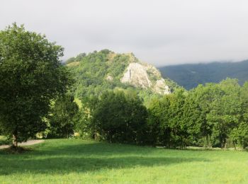
Trail Walking Montgaillard - Roc de Sainte-Julie - Photo
Walking 6.507
Km

Walking

Difficult
Montgaillard, Occitania, Ariège, France
6.5 km | 12 km-effort
2h 44min
415 m
415 m
Yes
houbart

Trail Walking Montgaillard - montgaillar  - Photo
Walking 4.058
Km

Walking

Easy
Montgaillard, Occitania, Ariège, France
4.1 km | 6.3 km-effort
53min
164 m
185 m
No
MICHEL BARRAL

Trail Equestrian Montgaillard - sentier_cathare 001 - Photo
Equestrian 99.799
Km

Equestrian

Very easy
Montgaillard, Occitania, Ariège, France
100 km | 147 km-effort
Unknown
3513 m
3603 m
No
Lozère Cheval

Trail Walking Montgaillard - 5519946-Pic de l'Aspre Caraybat - Photo
Walking 14.831
Km

Walking

Very difficult
Montgaillard, Occitania, Ariège, France
14.8 km | 24 km-effort
5h 30min
719 m
717 m
Yes
pidjam

Trail sport Montgaillard - Sentier Cathares (déviation Foix/Montgailhard) - Photo
sport 2.814
Km

sport

Very easy
Montgaillard, Occitania, Ariège, France
2.8 km | 6.3 km-effort
Unknown
347 m
9 m
No
loic09

Trail Walking Montgaillard - pin de sucre  - Photo
Walking 2.315
Km

Walking

Easy
Montgaillard, Occitania, Ariège, France
2.3 km | 4.5 km-effort
1h 0min
162 m
163 m
Yes
jopost

6 trails displayed on 6

FREE GPS app for hiking

Logo SityTrail SityTrail

IGN / Geographical institutes

Download SityTrail from the App Store Download SityTrail from Google Play

Logo SityTrail SityTrail World

The world is yours!

Download SityTrail from the App Store Download SityTrail from Google Play Download SityTrail on Huawei AppGallery

Activities

Close
My subscriptions