


Chalencon circuit 1

choubaka77
User
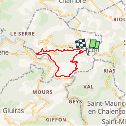

Length
10.9 km

Max alt
722 m

Uphill gradient
479 m
Km-Effort
17.2 km

Min alt
276 m

Downhill gradient
473 m
Boucle
Yes
Creation date :
2019-01-15 12:43:54.622
Updated on :
2019-01-15 12:43:54.622
3h00
Difficulty : Medium

FREE GPS app for hiking
 SityTrail
IGN / Geographical institutes
SityTrail Plus
The world is yours!
About
Trail Walking of 10.9 km to be discovered at Auvergne-Rhône-Alpes, Ardèche, Chalencon. This trail is proposed by choubaka77.
Description
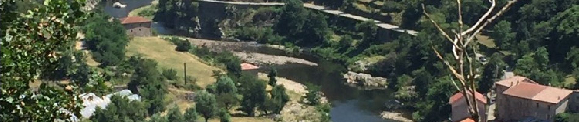
Départ pour un tronçon de la Via Dolce avec une bonne descente et pour finir une bonne montée !!!! Attention en été avec les grosses chaleurs préférez dans ce cas un matin à la fraîche.
Photos


Positioning
Country:
France
Region :
Auvergne-Rhône-Alpes
Department/Province :
Ardèche
Municipality :
Chalencon
Location:
Unknown
Start:(Dec)
Start:(UTM)
624467 ; 4970208 (31T) N.
Comments