


Giromagny

tiene
User
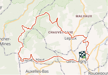

Length
23 km

Max alt
1144 m

Uphill gradient
1145 m
Km-Effort
38 km

Min alt
469 m

Downhill gradient
1142 m
Boucle
No
Creation date :
2018-07-09 15:46:06.711
Updated on :
2018-08-11 15:07:17.257
7h44
Difficulty : Difficult

FREE GPS app for hiking
 SityTrail
IGN / Geographical institutes
SityTrail Plus
The world is yours!
About
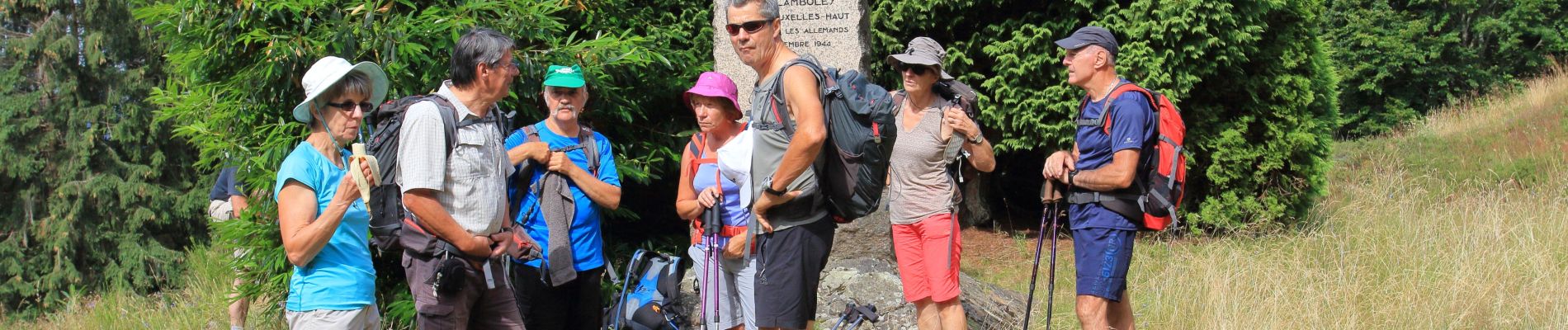
Trail Walking of 23 km to be discovered at Bourgogne-Franche-Comté, Territoire-de-Belfort, Giromagny. This trail is proposed by tiene.
Photos

Positioning
Country:
France
Region :
Bourgogne-Franche-Comté
Department/Province :
Territoire-de-Belfort
Municipality :
Giromagny
Location:
Unknown
Start:(Dec)
Start:(UTM)
337157 ; 5289862 (32T) N.
Comments