Trail Walking Lalley - col de la croix haute - Photo

col de la croix haute

 dominiq
dominiq

User

© OpenStreetMap contributors
Length
Length
6.6 km
Max alt
Max alt
1133 m
Uphill gradient
Uphill gradient
324 m
Km-Effort
Km-Effort  
10.9 km
Min alt
Min alt
829 m
Downhill gradient
Downhill gradient
324 m
Boucle
Boucle
Yes
Creation date :
2019-01-15 12:54:52.069
Updated on :
2023-01-02 19:04:06.047

(0 Reviews)

Walking
Walking
2h07
Difficulty : Medium

Scan this QR Code to open this trail in the SityTrail application

FREE GPS app for hiking

Logo SityTrail SityTrail

IGN / Geographical institutes

Download SityTrail from the App Store Download SityTrail from Google Play

Logo SityTrail SityTrail World

The world is yours!

Download SityTrail from the App Store Download SityTrail from Google Play Download SityTrail on Huawei AppGallery

About

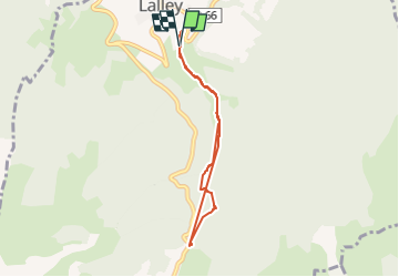
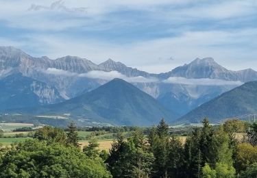
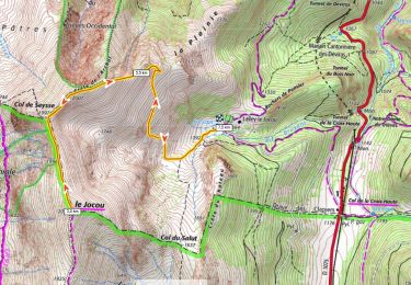
Trail Walking of 6.6 km to be discovered at Auvergne-Rhône-Alpes, Isère, Lalley. This trail is proposed by dominiq.

Description

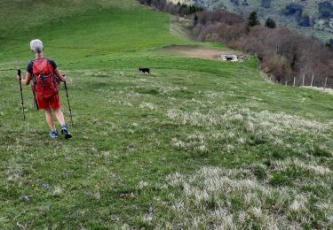
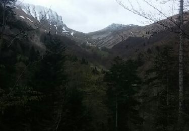
Attention à ne pas rater le sentier qui part à gauche, caché dans la végétation. Nous l'avons raté !

Elevation profile

Points of interest

Point of interest Lalley - Point 1 - Photo
dominiq
LALLEY 

Positioning

Country:
France
Region :
Auvergne-Rhône-Alpes
Department/Province :
Isère
Municipality :
Lalley
Location:
Unknown
Start:(UTM)
712050 ; 4959059 (31T) N.

Trails nearby

Trail Walking Lalley - Serre Motaire et Lazare - Photo
Walking
PapouBertrand

Walking

Very difficult
Lalley, Auvergne-Rhône-Alpes, Isère, France
14.6 km | 24 km-effort
23h 45min
Yes
Trail Walking Lalley - le Rognon depuis le col de Lus - Photo
Walking
cmarit

Walking

Medium
(1)
Lalley, Auvergne-Rhône-Alpes, Isère, France
14.6 km | 24 km-effort
6h 53min
Yes
Trail Walking Lalley - Rognon - Bouturet - Col des Selles - Photo
Walking
patjobou

Walking

Medium
Lalley, Auvergne-Rhône-Alpes, Isère, France
15 km | 25 km-effort
6h 18min
Yes
Trail Road bike Le Monestier-du-Percy - Le Percy, lac de Monteynard et Mens en boucle - Photo
Road bike
scalpy

Road bike

Very difficult
Le Monestier-du-Percy, Auvergne-Rhône-Alpes, Isère, France
48 km | 62 km-effort
4h 22min
Yes
Trail Walking Lalley - rando depuis col lus la croix haute  - Photo
Walking
gibello

Walking

Medium
Lalley, Auvergne-Rhône-Alpes, Isère, France
13.4 km | 23 km-effort
5h 55min
Yes
Trail Walking Saint-Maurice-en-Trièves - col - Photo
Walking
goizet

Walking

Very easy
Saint-Maurice-en-Trièves, Auvergne-Rhône-Alpes, Isère, France
10.1 km | 17.1 km-effort
4h 1min
Yes
Trail Snowshoes Lalley - Le Jocou 2051m 700m+ depuis Lalley-Jocou (Col de Luz La Croix Haute) - Photo
Snowshoes
ericberlin

Snowshoes

Difficult
Lalley, Auvergne-Rhône-Alpes, Isère, France
7.4 km | 16.7 km-effort
5h 0min
Yes
Trail Walking Le Monestier-du-Percy - LE MONT BARAL - Photo
Walking
RD78-38

Walking

Medium
Le Monestier-du-Percy, Auvergne-Rhône-Alpes, Isère, France
7.8 km | 14.9 km-effort
4h 30min
No
Trail Snowshoes Lalley - Col de la Croix Haute col du Salut - Photo
Snowshoes
markrei

Snowshoes

Easy
Lalley, Auvergne-Rhône-Alpes, Isère, France
8.1 km | 14.1 km-effort
4h 5min
No


Close
My subscriptions