


Monastère des voirons au départ du monastère de bethléem

LebeauPhil
User

Length
10.2 km

Max alt
1479 m

Uphill gradient
689 m
Km-Effort
19.4 km

Min alt
826 m

Downhill gradient
701 m
Boucle
Yes
Creation date :
2019-02-24 19:28:57.14
Updated on :
2019-02-24 19:28:57.157
3h53
Difficulty : Difficult

FREE GPS app for hiking
 SityTrail
IGN / Geographical institutes
SityTrail Plus
The world is yours!
About
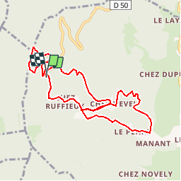
Trail Walking of 10.2 km to be discovered at Auvergne-Rhône-Alpes, Upper Savoy, Boëge. This trail is proposed by LebeauPhil.
Positioning
Country:
France
Region :
Auvergne-Rhône-Alpes
Department/Province :
Upper Savoy
Municipality :
Boëge
Location:
Unknown
Start:(Dec)
Start:(UTM)
296278 ; 5122486 (32T) N.
Comments