


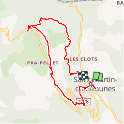
Boucle de Pelens

GrouGary
User

Length
10.5 km

Max alt
1649 m

Uphill gradient
631 m
Km-Effort
18.9 km

Min alt
1043 m

Downhill gradient
628 m
Boucle
Yes
Creation date :
2018-09-02 08:06:22.753
Updated on :
2018-09-02 08:06:22.753
5h26
Difficulty : Easy

FREE GPS app for hiking
 SityTrail
IGN / Geographical institutes
SityTrail Plus
The world is yours!
About
Trail Walking of 10.5 km to be discovered at Provence-Alpes-Côte d'Azur, Maritime Alps, Saint-Martin-d'Entraunes. This trail is proposed by GrouGary.
Description
itineraire reliant hameaux, chapelles et belle vue sur aiguille de pelens a l'auberge des aiguilles
Positioning
Country:
France
Region :
Provence-Alpes-Côte d'Azur
Department/Province :
Maritime Alps
Municipality :
Saint-Martin-d'Entraunes
Location:
Unknown
Start:(Dec)
Start:(UTM)
320882 ; 4890079 (32T) N.
Comments